It's Friday April 19, 2024
News From The Village Updated Almost Daily
September 5, 2019
Article updated 3:46p Thurs Sept 5Surge. It’s the major impact hurricanes have on Oriental. Often folks prepare for winds, but it’s high water levels that have caused the real damage in the last three major hurricanes.This century has seen three serious hurricanes visit Oriental: Isabel (2003), a 9 ft surge, Irene (2011), a 9.5 ft surge, and Florence (2018), a 9.6 ft surge.
Will Dorian have a similar effect? The guidance so far says we will see significant surge, but perhaps not to the extremes that those storms delivered. All of the above storms passed more closely and more slowly on their stormy treks. Hurricane Dorian is forecast to pass just offshore of Cape Lookout, and pass by fairly quickly, shortening the time Dorian’s winds can push Pamlico Sound waters down to flood our area.
Here’s a look at the recent surge forecasts:
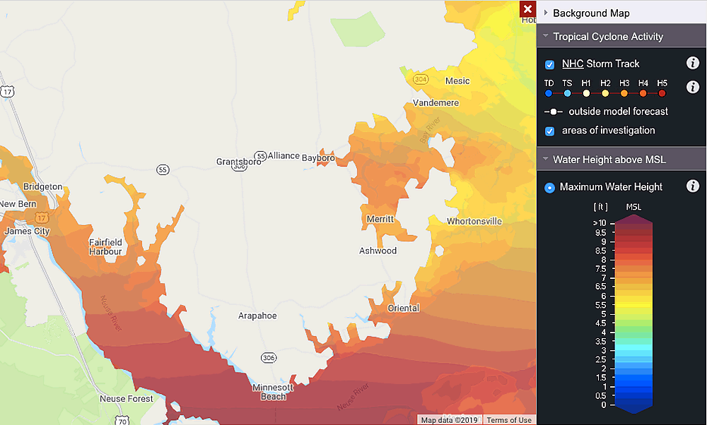
CERA – Coastal Emergency Risks Assessment
updated Thur Sept 5 1:30p
This map bills itself as Storm Surge Guidance for Emergency Managers and Decision Makers. It shows levels above MSL – Mean Sea Level. This should be close to how we have measured peak levels in the past. It now suggests an 7 to 8 ft surge for Oriental, Minnesott Beach 8-9 ft, Whortonsville & River Dunes 6 to 7 ft.
click surge images for larger view
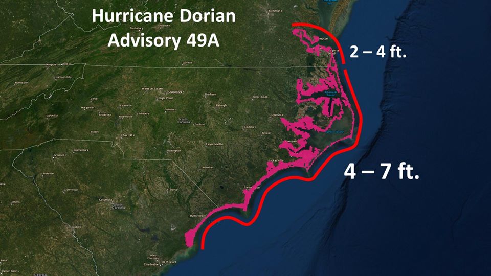
NHC Surge Forecast
info updated Thursday Sep 5 3:46p
NHC now shows us in a 4-7 ft surge range.
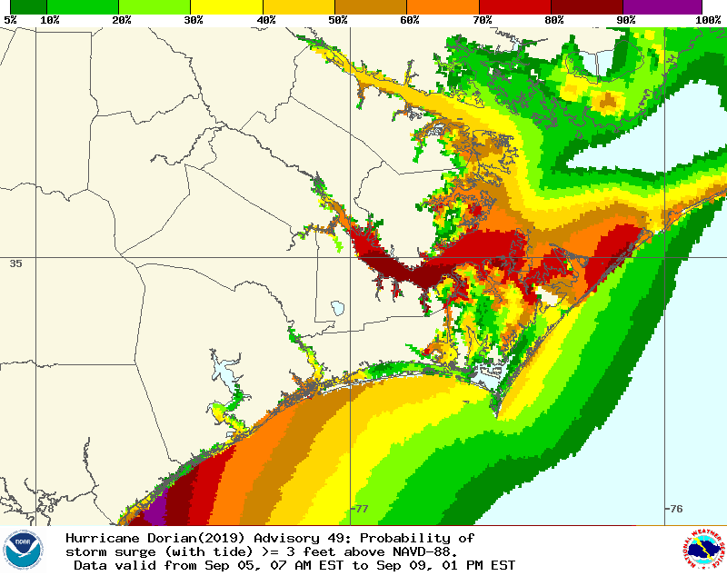
NOAA’s Probabilistic Tropical Storm Surge (P-Surge) model
updated Thu Sept 5 1:34p
This model shows levels above Datum. This should translate to above normal water levels. At left the chance of 3ft or more, at right 6 ft of surge or more. The projections state we have a 70-80% chance of 3ft or more – and as of Thursday afternoon a 10-20% chance of a 6 ft or more surge for Oriental.
click surge images for larger view
The predictions above are significantly different. Whatever the final outcome, this surge will be relatively fast (not like Florence that was around for days.)
Which is right? The NHC surge prediction is very general – the same forecast covering all of coastal NC. The CERA forecast is very specific. We’ll know Saturday.
TownDock gets asked a lot – “what do you really think?” We think we don’t know better than the models above.
Could these predictions change? It’s Thursday now. Probably not much. TownDock will update this article as new data is available.