It's Tuesday April 23, 2024![]() Dock Quote: “Do you want...
Dock Quote: “Do you want...
News From The Village Updated Almost Daily

Upcoming Events
- Empowerment Self-Defense for Women: April 23 & 25
- Open Mic Night @ The Silos - Wednesday
- Wednesday Night Sail - 5:30p
- Celebrating Caregivers - April 24
- Town Budget Meeting #1 - April 24
- Pamlico County Special Olympics Spring Games - April 26
- Alex Williams @ The Old Theater - April 27
Rezonings Denied, SUP Review Coming:

April Town Board Meeting 2024. The Story
Rumors Addressed, Questions Answered:
March Town Board Meeting 2024. The Story
Sailpack 2024 This Weekend:

Everything you need to know about this weekend. Guest Columnist
The 2024 Oriental In-Water Boat Show:
Motorboats, Sailboats, and a Masthead Float. The Story
Thanks to Neuse Neighbors Volunteers:

April is Volunteer Month. Letters To The Editor
2024 Pet Parade:

A pirate ship, a pun, and an impersonation. The Story
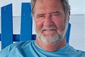
Douglas 'Doug' Wayne Gaither, 1945-2024:

Repairman, Husband, Helper. The Story
RV Park Proposed Near Whittaker Creek:
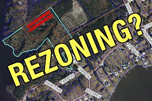
Residential to Multi-Use Rezoning Requested. The Story
Josephus "Jos" J. H. P. Muffels, 1953 - 2024:
Adventurer, Craftsman, Loving Husband. The Story
The Spring Break 'Trophy' Regatta:
Collegiate sailors train in Oriental. The Story
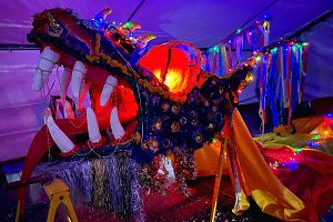
The 2024 Dragon Burn:
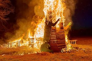
Smoke, fire, and ash. The Story
Chowder Chow-Down:

The 2024 Oriental Woman's Club Chowder CookOff. The Story
Letters: Thanks from the Friends of the Library:
Appreciation for the helping hands. Letters To The Editor
Wes Barbour and SV Summer Wind:
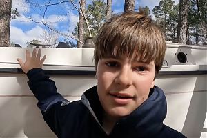
A boy and his sloop. The Shipping News
"You Are Wrong.":

February Town Special Meeting. The Story
Phillip Ira Sax, 1948 - 2024:
Solo sailor, celestial navigator, dear friend. The Story
Oriental's 125th Birthday Celebration Guide:

What's happening, where and when. The Story
Resignation, with Regrets:

"This was supposed to be my forever house". The Story
An Irritated Public & A Question Left Unanswered:
Febraury 2024 Town Board Meeting. The Story
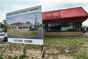
Ground Breaking: A New Library Is Coming:

Work on a dedicated space begins. The Story
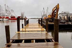
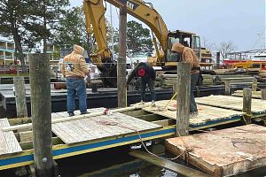
Worms Damage Dock, Cause Closure:

Waiting on bids, no time frame for a fix. The Story
Anna Ice, 1938 - 2024:

Loving friend, mother, and helper. The Story
48 Hour Film Project - 2024:

Small Town Filmmakers on the Big Screen. The Story
Alan Herlands, 1949 - 2023:

Family Man, Loving Husband, Commissioner. The Story
Winterization 2.0:

Get Your Boat Ready For Freezing Temps. Captain's Blog
A More Accessible Oriental:

Public input wanted. Letters To The Editor
Gerry Crowley, 1944 - 2023:
Commodore, Sailor, Volunteer, Friend. The Story
Dragons Ring in 2024:
A new dragon joins the run. The Story
Friends Of The Dragon 2024:

It takes a village to house a dragon. The Story
Pauline and SV Elektra:
Powered by wind, sun, and music. The Shipping News
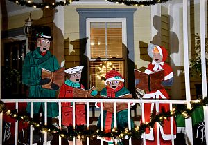
The Nativity, A Few Carols, & Lots of Lights:

The other side of The Spirit of Christmas. The Story
2023 Spirit of Christmas Parade:

Candy, kids, and Santa. The Story
Barbara Gaines, 1937 - 2023:

Mother, educator, adventurous spirit. The Story
2023 December Town Board Meeting:
Two new Commissioners & legal questions about liaison position. The Story
2023 Spirit of Christmas Schedule:
What's happening, where and when. The Story
Village Gallery Is Closing Dec 24:

Gallery Founder Judy Wayland Writes In. The Story
PCC President Retiring:

Dr. Jim Ross retires. The Story
2023 Turkey Pedal:

500 wheels and a flock of turkeys. The Story
Giving Locally 2023:

Area Non-Profits That Could Use Your Donations. The Story
The 2023 Spirit of Christmas is Coming:
How you can help out or join in. The Story
Melinda Penkava-Smith, 1959 - 2023:

Journalist, NPR Reporter, Rock DJ, Gardener, Wife & Friend. The Story
Bradley Scott Pickard, 1973 - 2023:

Adventure seeker & loving father. The Story
Election Results 2023:

Price, Roe, Litzenberger, Overcash, Crosser elected. The Story
Meet the 2023 Oriental Town Board Candidates:

The candidates up for election Nov 7. The Story
The Coati & The Mermaid:

A ring-tailed crew member not seen before. The Shipping News
A Library Building by the Numbers:

$2.159 million raised so far. The Story
Letters: An Update, Extension, and Shift:
The Whittaker Creek Channel. Letters To The Editor
Letters: Thanks, from England:

A salute from across the pond. Letters To The Editor

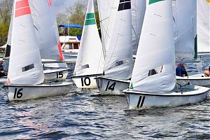
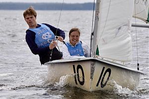
FJs crossing the starting line in close quarters. From Saturday’s SailPack Oriental Intercollegiate Regatta.
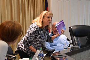
3:22p Recent town meetings have been long. Sometimes, really long.
The April meeting was 2 hours, March clocked in at 3 1/2 hours. It’s municipal endurance that hopefully won’t become the norm this year (in the past, a bit over an hour was more common).
Unfortunately, long meetings have led to long meeting reports.
Here are two most recent:10:14a Ol’ Front Porch Music Festival favorite The Gospel Ensemble is one of four groups performing at this weekend’s Gospel, Blues & Rockin’ BBQ.
Check them out:Hear them live, along with Jill & Shane, John Brown, and The Southern Hellcats starting at 3:30p Saturday.
This Tuesday and Thursday, from 5:30 to 7:30p, Darla Bolon teaches self-defense for women at Pamlico Community College. $25 for both classes, and pre-registration is required.
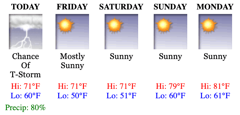
Cool temps are back. Partly sunny today and cool temps again. High near 60, lows tonight near 40.
• Oriental NC Forecast
• Neuse River Marine Forecast
• Pamlico Sound Marine Forecast
• Weather Radar
• HarborCam
2:41p The Jacksonville (FL) Fins are the winners of the 2024 Sailpack Regatta. Host team NC State came in second. Despite rain & high winds (and a few capsizes), there were multiple races today.
1. Jacksonville (FL) Fins
2. North Carolina State Wolfpack
3. University of South Florida Bulls
4. Texas Longhorns
5. Virginia Wahoos
6:50a Unfriendly conditions forecast for the Neuse may end the Sailpack Regatta earlier than planned today.
Today… Ne Winds 5 To 10 Kt, Increasing To 10 To 15 Kt This Morning, Then Becoming N 15 To 20 Kt With Gusts Up To 25 Kt This Afternoon.
• Oriental NC Forecast
• Neuse River Marine Forecast
• Pamlico Sound Marine Forecast
• Weather Radar
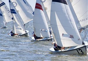
The Sailpack Regatta leaders after it was all added up yesterday:
1. University of South Florida Bulls
2. North Carolina State Wolfpack
3. Jacksonville Fins
4. Texas Longhorns
5. Virginia Wahoos.
Today’s results added in will determine the Regatta winner(s).
Complete coverage at this link.
3:10p NC State Sailpack sailors have had a good afternoon, now leading the regatta.
2:12p So far today, Jacksonville (FL) is leading the Sailpack Regatta. NC State is in third, many races to go.
It’s light air today, with north winds staying under 10 knots. Sunday is forecast to freshen to 10-15.
7:35a It’s not a perfect sunny day for sailing. A cloudy start, a 30% chance of rain.
No capsizes likely today – south winds @ 5 knots forecast. Light air sailing skills will be on display, as the Sailpack Regatta is underway.
• Oriental NC Forecast
• Neuse River Marine Forecast
• Pamlico Sound Marine Forecast
• Weather Radar
TownDock Senior Management is a bit grumpy this morning. A fave “old bicycle is missing, last left at the Bean. Now found. Faith in planet restored.
3:44p Potlucks and BBQs, regattas and rice hulls. All ready for the weekend.
No food truck at the brewery tonight. Bring your own or take part in the potluck social. Mac the Swamp Donkey plays Tex-Mex tunes in the beer garden from 5-7p.
Down the road, Ken Belangia serenades Red Rooster patrons starting at 7p.
 Saturday morning, pick up some eggs and honey, or check out the stained glass and wood carving at the Oriental Farmer’s Market at 8a. The SailPack Regatta at 9a for sailors, 10a for spectators. Viewing is best done from Lou Mac Park.
Nautical Wheelers serves five South African wines under the covered porch at 2 & 3p.
Tidewater Grain has rice hulls for your garden (or bean bag or horse stalls). Yours between 10a – 2p, for a donation to the FFA kids on site to help out.
At 5:30p, join the college teams of the SailPack Regatta for a BBQ dinner at Bow to Stern. Tickets are $15 and help the sailing teams defray the costs of competition.
Walk-In Bathtub Improv Comedy Group performs – with a little mad-lib help from the audience – at 7:30p at The Old Theater.
Sunday, the college kids are on the water at 10a again, sailing through the last of the regatta races before heading home midday.
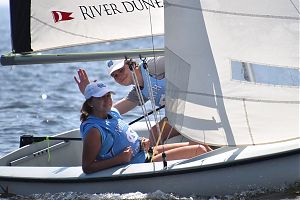
1:43p The average age in Oriental will drop significantly this weekend; collegiate sailors are coming to town. 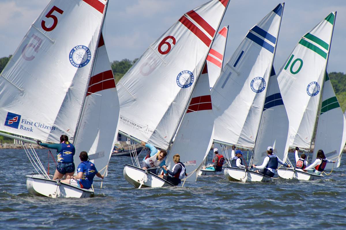
They’re here for the SailPack Oriental Intercollegiate Regatta – happening this Saturday and Sunday.
Eighteen colleges, 36 boats, and around 130 students and coaches are arriving tonight and Saturday morning.
NC State SailPack coach Dana Magliola writes in with the weekend schedule and an invitation to dinner.
12:349 Dinner, dancing, and a week long trip (or two) up for auction. It’s happening at the Hope Regala on May 10 & 11.
Get tickets to the Friday night BBQ with live music or the Saturday night Gala. Bid on trips to Anguilla or Tuscany, entry to the 2025 Augusta Practice Round, gourmet dinners and more in the live auction.

Purchase a ticket for the $10k Golden Raffle (about 40 are left). Book a Boater’s Dream Package at River Dunes.
Whichever option you choose, it all helps Hope Clinic in their mission to help the uninsured in Pamlico County. (RSVP requested by Monday, April 22.)
See all the experiences available in Saturday night’s live auction.
10:38a Improv Comedy. It’s happening Saturday evening at The Old Theater. 
Walk-in Bathtub Comedy Improv Team returns to Oriental. This time they’re performing & teaching.
Join the free improv workshop at 3p at The Old Theater. Learn about timing, teamwork, spontaneity, and observation.
At 7:30p, be part of the audience and the show – performers take audience suggestions and build them into a performance.
Get tickets for the show online or at Nautical Wheelers. To join the Improv workshop, email president@oldtheater.org and get your name on the list.
9:57a Earth Day is Monday April 22, but many Earth Day events happen this weekend. One area business is celebrating by giving away an earth friendly additive for your garden.
TownDock stopped by Tidewater Grain, and talked with Al Spruill:
To get your free rice hulls, visit the Tidewater Grain Mill Saturday from 10a – 2p. It’s at 570 Callison Road just outside Oriental, off Highway 55 near Paul’s Produce Stand.
FYI, while you visit (and get your free rice hulls), you can purchase some Tidewater Rice if you wish. For rice purchased Saturday, Tidewater Grain is donating 100% of all revenues to the Pamlico County FFA.
11:11a Wandering through the boat show, TownDock crew thought they had found a miniature blimp.
Nope, it’s a “masthead float”… from the crew at B&B Yacht Designs.
We asked Alan Stewart to explain:
Want a masthead float? They are on the B&B web site.
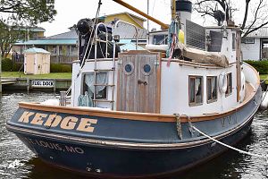
The above aside, there were indeed boats at the Oriental Boat Show. A lot of ‘em. Some with fancy interiors, some with no interiors. Boats for sale, boats for charter.
Check out the 2024 Boat Show scene here.
9:08a Hints of summer are visiting. Highs near 80 every day through Saturday.
Then back to mid 60s – and the possibility of rain – on Sunday.
• Oriental NC Forecast
• Neuse River Marine Forecast
• Pamlico Sound Marine Forecast
• Weather Radar
• HarborCam
Trying to figure out what makes life worth living? So is the One-Off Book Club. They meet today at 4p in the back room of M&Ms to discuss the book Life Worth Living. No need to have read the book to attend.
This evening is the first meeting of the Community Interfaith Youth Group. Sponsored by Oriental United Methodist Church, the group welcomes middle and high school students. Meet at Lou Mac Park from 5-6:30p.
11:57a The boats have left. But the sailors are coming.
Last weekend was the 2024 In-Water Oriental Boat Show. 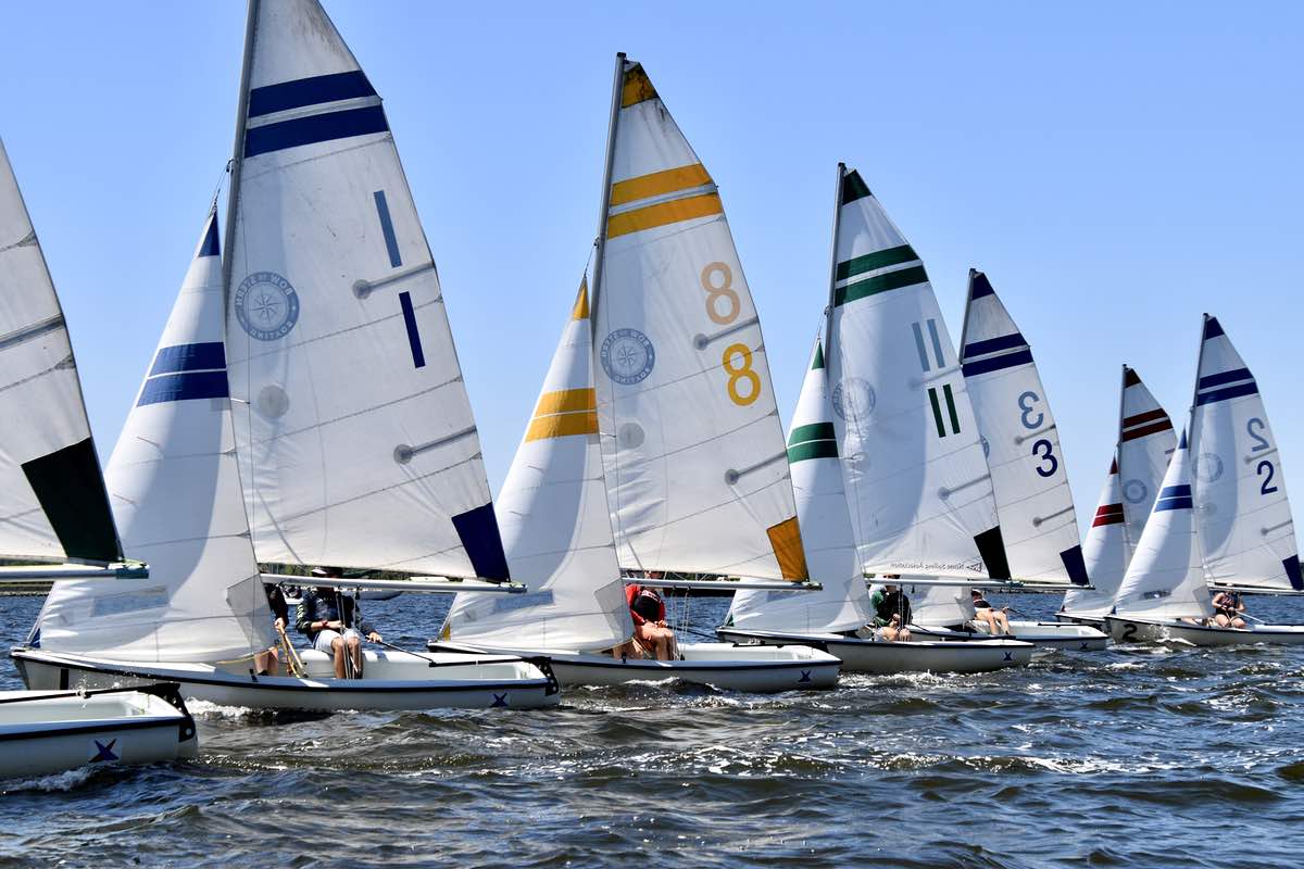 Next weekend is the SailPack Regatta.
Eighteen Universities send their sailing teams to compete. The Regatta, part of the South Atlantic Intercollegiate Sailing Association conference.
Sailors arrive in town Friday night, and you can watch the races from Lou Mac Park on Saturday and Sunday.
SailPack Coach Dana Magliola writes in about housing sailors and the coming regatta:Tonight, Pamlico County Commissioners gather for their second monthly meeting, at the Bayboro courthouse annex at 7p.
April is National Volunteer Month. Neuse Neighbors Network says thanks to those that make it happen.
2:46p Congrats to Sharon Gilbert of Oriental, winner of the Oriental Rotary Raffle at the boat show. The prize is a Mercury 6hp outboard, donated by Sailcraft Service boat yard. Also part of the raffle, the 5050 drawing. Burton Kennedy won $650.
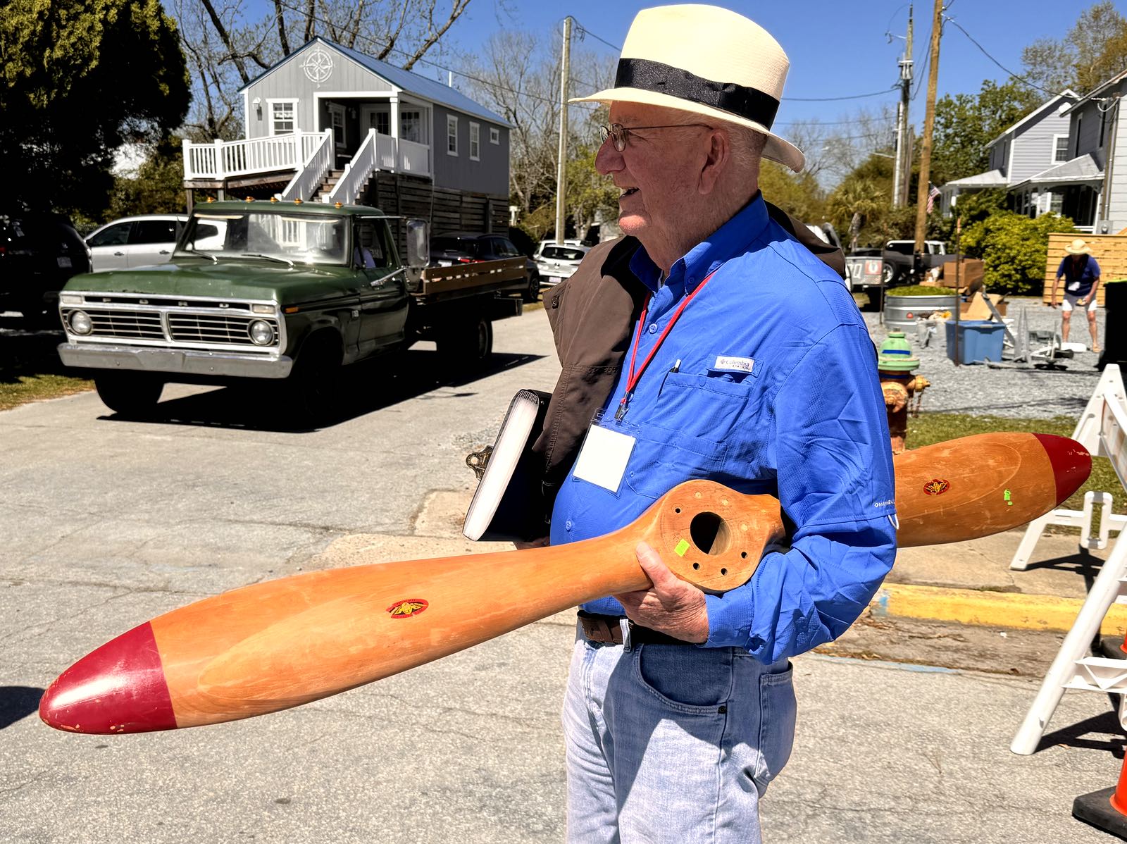
There was an airplane propeller on the cover of TownDock yesterday… for sale at the boat show. What Happened?
Spotted on Hodges Street a few minutes ago, a new prop owner: Boat Show Organizer John Barlow says it is destined for his wall.
10:10a One more day of the Oriental Boat Show… it’s open 10a – 3p today on Hodges St by the harbor. The winds have finally calmed down, the harbor is nearly still this morning.
Sunny & upper 70s forecast today, then warming up even more Monday: high near 85. On the Neuse SW winds 5-10 knots today, 10-15 Monday.
• Oriental NC Forecast
• Neuse River Marine Forecast
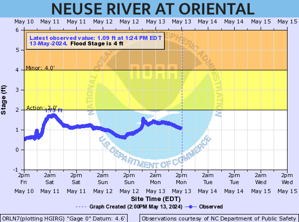
• Oriental Water Level Gauge
11:53a Pints for Parkinson’s. What’s that mean? 
Today at New Village Brewery you can drink beer and support the Bike Box Project.
Bike Box in New Bern provides support for those with Parkinsons through exercise programs, including Rock-Steady Boxing.
Many in Pamlico County enjoy the benefits of this program. Pints for Parkinson’s is today 3p til 7p at the brewery.
11:47a. While the boat show is showin’, there’s some art in town too.
The artists of the former Village Art Gallery are displaying today in the greenspace next to Barcos. They are there til 4:30p today.
11:32a The 2024 Oriental In-Water Boat Show continues today & Sunday. 
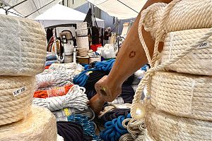
The corner of Hodges and S. Water Street is home to the Nautical Flea Market. Vendors and power boats line Hodges Street. The docks have sail & power vessels to tour.
Your brain can learn stuff too. Catch a seminar at the Oriental Marina and Inn. The Saturday Seminar schedule:
• 12-1: Diesel engine maintenance and troubleshooting (Darrell Foster, Foster Mobile Marine)
• 1:30-2:30: Docking: the ten commandments (John Rahm, Captain, Third Wave Sailing)
• 3-4: How Professionals would Sell your Boat (Julie Rahm, CPYB,Triton Yachts)
2:20p Here’s the weekend boat show schedule:
- Friday, noon – 6p
- Saturday, 10a – 6p
- Sunday, 10a – 3p
While calmer than yesterday, it is breezy today. On the Neuse 15-25 knots. Winds are from the west, which protects the downtown boat show from getting too much wind.
• Oriental NC Forecast
• Neuse River Marine Forecast
• Oriental Water Level Gauge
• Weather Radar
8:43a Hodges Street along the harbor is closed to vehicle traffic & boat show preparations are underway.
Gates open at noon. $10 gets you in for the whole weekend.
Cherry Branch – Minnesott Beach Ferry is on an amended schedule this morning;  only one boat is in operation.
From Cherry Branch: 9a, 10a, 11a, Noon
From Minnesott Beach: 9:30a, 10:30a, 11:30a, 12:30p.
9:53a Windy, with rain on the way today. But the weekend weather is near perfect for the Oriental In-Water Boat Show.
An 80% chance of thunderstorms this afternoon, with south winds 15-25 mph, gusts up to 40. High near 70.
This weekend, it’s a different story. Sunny and mostly sunny with highs near 70 Friday and Saturday, near 80 Sunday.
The winds will stick around Friday and Saturday: out of the southwest and west at 15-20 mph, and gusting up to 30.
4:23p They didn’t do it. The Tree Board is innocent.
Drive down First Avenue in the Village, and between Mildred and High Streets, you’ll notice this:

Oriental Tree Board member Missy Tehnet says it was not part of their routine trimming. It was Duke Energy. The power company has the right to trim trees that may interfere with their lines.
They were supposed to take the branches with them. Otherwise, Town has to pay to absorb the cost of getting rid of them.
The Town Wide Yard Sale, scheduled for May 4, is less than a month away. 
If you want to be on the official Town Yard Sale Map, you have until Friday, April, 26 to contact Marsha Paplham.
It’s easy enough – give her the address of the yard sale. She’ll put it on the map.
Contact her at 252-675-5142. Want to see what you’re in for? Check out the treasures for sale at the 2023 Town Wide Yard Sale.
9:29a The NC State’s sailing team & 17 other university teams are coming to Oriental. About 130 collegiate sailors are expected in town for the 2024 Sailpack Regatta, April 20-21.
Sailpack Coach Dana Magliola still needs help. He writes in to ask for help to house collegiate sailors. Some are from North Carolina… others from as far away as Texas and Florida:
 We have 72 people assigned, but still need to find housing for 58 collegiate sailors.
You don’t need a ton of bedrooms or even beds to help. Couches work well and open space for air mattresses is good as most sailors have air mattresses from normal college sailing regatta travel life.
If people have whole houses they’d offer, we can ensure whichever team stays there has an adult coach with them. (House donations will also qualify for a tax-deductible contribution receipt.)
Sailors will be in town on Friday, April 19 and leave Sunday, April 21 in the late afternoon.
To help with housing, please email, text, or call Coach Dana Magliola (dana@sailpack.org, 919-946-5445).
Here’s the list of teams registered to compete in Oriental:
• Clemson
• Christopher Newpoart University
• Embry-Riddle
• Florida Tech
• University of Indiana
• Jacksonville University
• NC State
• SUNY-Stony Brook
• The Citadel
• University of Florida
• University of Maryland
• University of Maryland-Baltimore County
• UNC-Wilmington
• University of North Carolina
• University of Texas
• University of South Florida
• University of Virginia
• William & Mary
3:45p Vendors, seminars, and boats. Lots of boats.
They’ll be here this Friday through Sunday for the annual Oriental In-Water Boat Show.
Take a walk along the waterfront at the harbor. Find a nautical treasure or two, or that perfect dream boat.
Check out the scene from the 2023 Oriental In-Water Boat Show here.
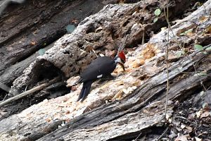
9:18a Birding. It’s a thing in and around Oriental. 
Pamlico Community College holds quarterly classes teaching students to identify birds, venturing out on early-morning birding field trips.
But if you’re just looking to take a walk around the village and get to know the birds in town, PCC can help with that too.
The Birding Apps Exploration class at PCC takes students through the apps available to help identify, photograph, and record birds in your area. The two-session class starts this Wednesday, April 10. has changed dates: Mondays, April 29 & May 6. It’s free. All you need to do is register.
Partly sunny and high today in the mid 70s. Southwest winds at 10 – 15 mph.
• Oriental NC Forecast
• Neuse River Marine Forecast
• Oriental Water Level Gauge
• Weather Radar
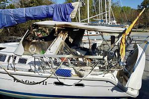
11:57a Sunday morning, John Bee’s Hunter 42 SV Pathfinder II caught fire at the SailCraft Marina Docks (adjacent to but separate from SailCraft Services boatyard).
John and his black lab Jack are liveaboards who have been visiting Oriental for years.
Pathfinder was towed away from the dock to Zimmerman Marine and held in the travel lift overnight.
There’s a solar eclipse today. 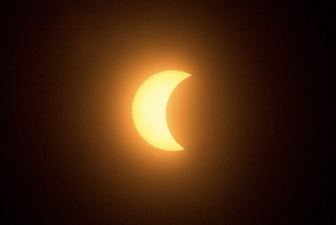 While Oriental is far from the direct path, the town will be treated to a partial solar eclipse.
At about 2p, the moon will pass between us and the sun, casting a shadow on the sun. We’ll see about 70% of the sun covered – the maximum we can view from Oriental, NC – around 3:15p.
It will start slipping away again, and the sun will fully reemerge about 4:30p.
We’ve been treated to the full eclipse show before, back in 2017. Check out the coverage from Lou Mac Park and the 2017 eclipse viewing here.
Electric Quiet Torque QT 10.0 sailboat motor
St. Barts Yachts New Power and Sailboats in Stock
Moving, Free and For Sale Items
Newly Renovated Cottage In Oriental
1977 San Juan 23 - $3,500
Driver/ helper
There Is A Consulting Architect In Oriental
Waterfront Retreat
Golf Course Property in Minnesott Beach
Del Sol and her slip are for sale
Commercial Property - Auto Repair Shop
Bookcases, Treadmill and Pet Carrier
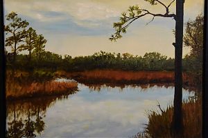
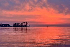
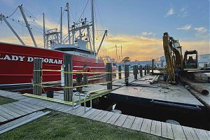
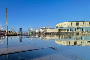
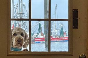
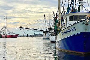
Recent cover photos: