It's Thursday April 18, 2024![]() Dock Quote: “Things which matter...
Dock Quote: “Things which matter...
News From The Village Updated Almost Daily
October 13, 2016
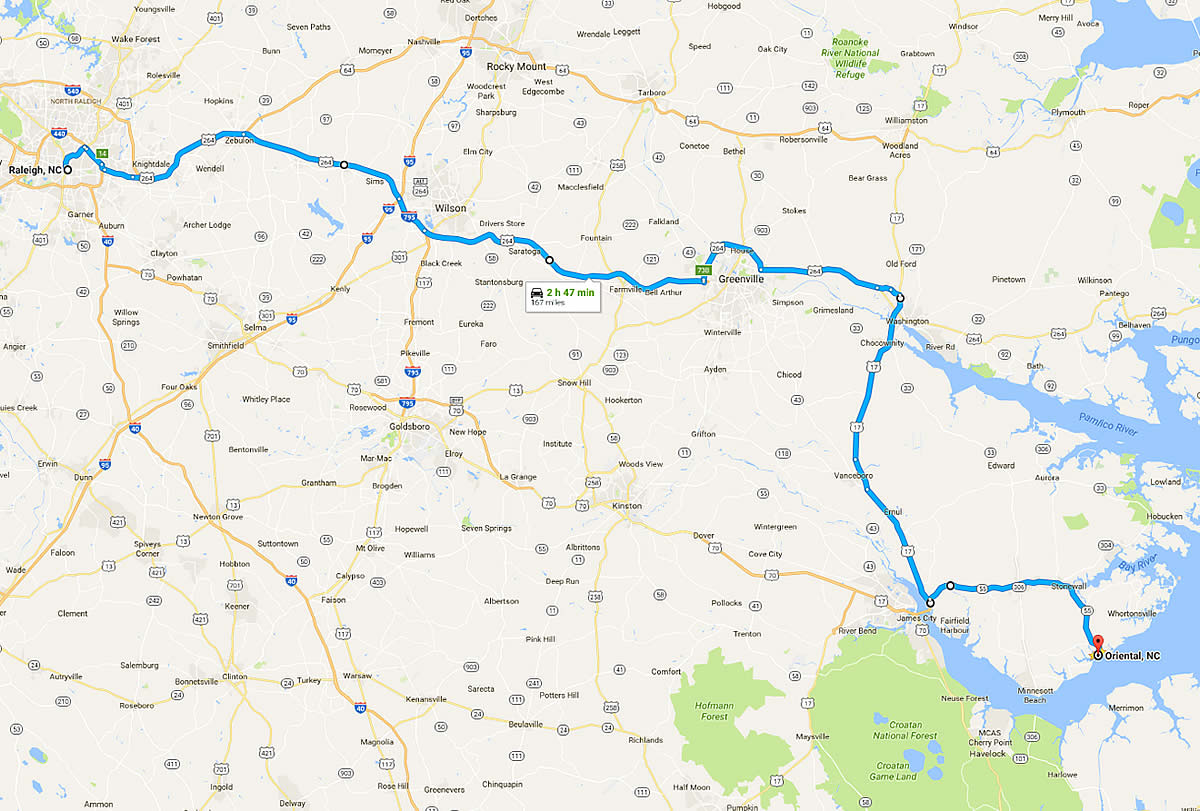
Forecast Flooding on Highway 70 at Goldsboro and Kinston has made the usual route to Oriental likely impassable. But it appears there is a way, and it isn’t that much longer. 264 > 17 > 55. That simple. It does pass over a significant body of water – the Pamlico River at Washington. Water levels are a few feet above normal there, but Hwy 17 is high above the river.
While the map shows a Raleigh to Oriental path, adapting it from other points west is easy. Just find US 264, and follow from there.
Update Oct 16 Sun 11a Hwy 264 had a detour Friday – but is now reported clear to pass in both east & west directions.
Use this product at your own discretion and sole risk. There are no warranties of any kind. This map might not work. Not to be used for navigational purposes. The map was created by a Oriental Rotary Club member and a dog.
Click here for a Google Map link for this route.
The state has a site showing all roads & problems. It has a lot of great info, but can be confusing to use:
https://www.ncdot.gov/traffictravelWater levels:
• Pamlico River At Washington Water Levels
• Neuse River At Goldsboro Water Levels
• Neuse River At Kinston Water Levels
• Tar River At Greenville Water Levels