home

forecast weather station weather station

Post-Tropical Cyclone Rafael Forecasters Discussion & Computer Models
Online Info About Atlantic Tropical Storms
Current Atlantic
   Tropical Systems
Atlantic Tropical
   Storm Outlook
Atlantic Tropical
   Weather Discussion
Online Info About Post-Tropical Cyclone Rafael:
• Post-Tropical Cyclone Rafael Tracking Chart • Post-Tropical Cyclone Rafael Public Advisory Statement
• Post-Tropical Cyclone Rafael Forecaster's Discussion & Computer Models
Post-Tropical Cyclone Rafael Forecaster's Discussion #
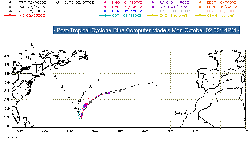
A graphic showing several computer modeled projected tracks is at the bottom of this page.
Post-Tropical Cyclone Rafael Discussion Number  30
NWS National Hurricane Center Miami FL       AL182024
300 PM CST Sun Nov 10 2024

The limited convection that Rafael was producing in its eastern 
semicircle has collapsed. Surface observations, visible satellite 
images, and a 1530z ASCAT-C pass show the surface circulation has 
become poorly defined and very elongated in the north-south 
direction. Since Rafael does not possess a well-defined center or 
organized convection, it no longer meets the definition of a 
tropical cyclone. This will be the final NHC advisory on Rafael.

The remnant low is expected to drift eastward over the central Gulf 
of Mexico tonight, then turn toward the south and southwest on 
Monday and Tuesday. The forecast calls for dissipation by Tuesday 
night, but this could occur even sooner if current trends continue. 
The elevated rip current risk along the northern and western Gulf 
Coast will likely continue into Monday. For more information, see 
products from your local NWS forecast office.

Additional information can be found in High Seas Forecasts issued by 
the National Weather Service, under AWIPS header NFDHSFAT1, WMO 
header FZNT01 KWBC, and online at 
ocean.weather.gov/shtml/NFDHSFAT1.php

Key Messages:

1. Swells are likely to cause life-threatening surf and rip current 
conditions along portions of the Gulf Coast through Monday.

FORECAST POSITIONS AND MAX WINDS

INIT  10/2100Z 26.1N  91.3W   30 KT  35 MPH...POST-TROPICAL
 12H  11/0600Z 25.8N  90.9W   25 KT  30 MPH...POST-TROP/REMNT LOW
 24H  11/1800Z 25.1N  90.7W   25 KT  30 MPH...POST-TROP/REMNT LOW
 36H  12/0600Z 24.1N  91.0W   20 KT  25 MPH...POST-TROP/REMNT LOW
 48H  12/1800Z 23.2N  92.0W   20 KT  25 MPH...POST-TROP/REMNT LOW
 60H  13/0600Z...DISSIPATED

$$
Forecaster Reinhart

The Forecaster's Discussion above often refers to several computer models. The graphic below includes multiple projected paths, showing what the different computer models indicate. The black line is the NHC (National Hurricane Center) path. This graphic is not an official NHC product. For the official NHC projected path of Post-Tropical Cyclone Rafael click here.


click image for a larger view

For more information about tropical storm computer models click here.