It's Sunday May 10, 2026
May 21, 2021
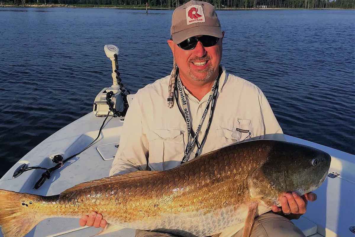
Captain Bobby Brewer is a fishing guide based in Oriental. He knows were you can and can’t go to fish locally. Bobby writes in to share the potential consequences of fishing where you shouldn’t.
In a past article Capt. John Rahm wrote about the bombing targets in the Neuse River and Pamlico Sound – their functions and importance. At the end of the article John stated “Despite the prospect of some good fishing, it is best to stay out of the bombing range.”
That is very true and entry can be very costly to the angler and the Marine Corps. If you enter the bombing range territories when you’re boating or fishing in the Neuse River and the Pamlico Sound, you can be charged with a federal trespassing misdemeanor. The punitive consequences of the act vary.Bobby Brewer of Baldheaded Bobby Guide ServicesAs a federal misdemeanor, it carries a hefty penalty: max punishment is up to 6 months imprisonment, a $5000 fine, and one year supervised release (a form of probation). Typical fines vary on the facts of each case, but $500 is not unusual for even a first time offender that claims mistake.
As an added cost, violators could be required to report a federal conviction on their record in situations like future employment. Court costs are a $10 special assessment. Additionally, there are the costs of having to appear before a federal magistrate in Wilmington in person, perhaps multiple times. Attorney fees could be in the thousands. Aggravating factors include bringing multiple parties, prior similar offenses, or trespassing for commercial or guide purposes.
A view of the activity at Bombing Target #11 from South Avenue.There are costs to the Marine Corps also. Prior to an exercise, spotting planes fly the area to ensure it is clear. The spotting planes that fly out prior to bombing runs have a camera that can easily read hull numbers from altitude. If your picture is taken within the boundaries, no excuse beyond an emergency situation is going to protect you from liability. It is important to know why the Marine Corps takes these areas so seriously: besides the fact that both ranges are littered with ordinance, not all exploded.
The Marine Corps put enormous time, effort, resources, and manpower into conducting a live fire exercise. Countless service-members work tirelessly to prep for these missions, often through the night, only to have it canceled due to a thoughtless angler at sun-up.
Over the past couple of years, the hurricanes and nor’easters have taken down many of the markings indicating these areas. In a lot of instances only wooden poles exist with no signs. With the many remaining poles from abandoned duck blinds, it can be a little confusing where these BTs start.
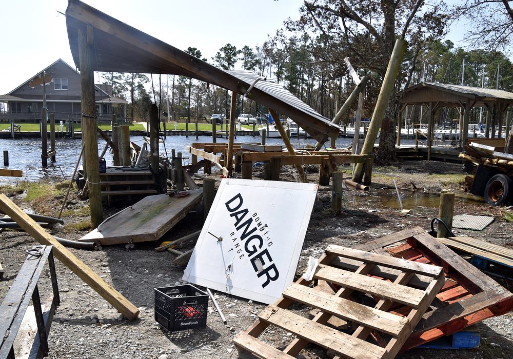
A bombing range sign washed up at Endurance Seafood during Hurricane Florence.These aren’t valid excuses for entering. It is every boat’s responsibility to do their homework and know the CFRs (Code of Federal Regulations). To understand the boundaries of these targets and the waters around Marine Corps Station Cherry Point, reference CFR 334.420 and CFR 334.430. Once you’ve read these Codes of Federal Regulations, I would recommend getting a navigational chart, Maptech #90, for further clarification. Also, some GPSs will have these BTs marked.
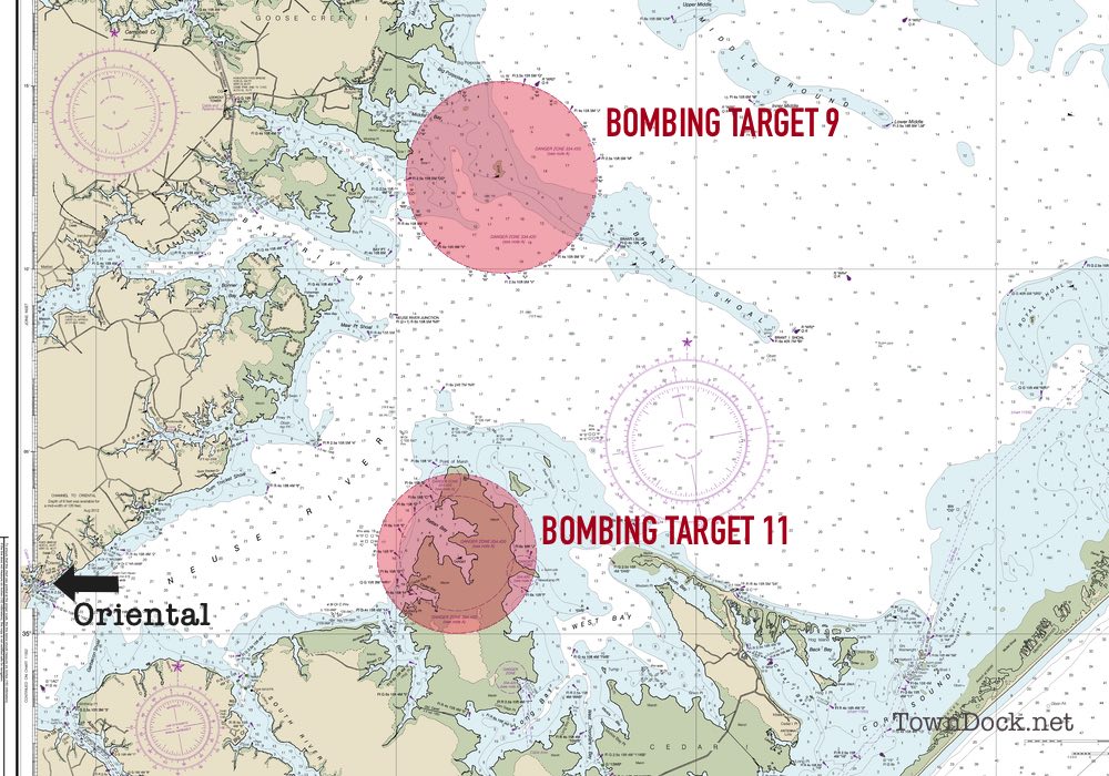
For the waters around Brant Island (BT 9) and between the mouths of the Bay and Pamlico Rivers, a 3 mile radius from the designated center of the range is closed at all times. It is marked in the water by a circular series of markers. Unfortunately, many of the signs are missing from their support posts and only the bare posts exist. However, it is indicated by a magenta circle on the aforementioned navigation chart and some GPSs.
The waters around Piney Island (BT 11) have 4 areas that are closed at all times. Some of these areas have markers present and some don’t. To better understand these areas reference CFR 334.420.b.1. However, it does have an area that is closed only when in use, which is approximately 5 days per month. I refer to this sometime open area as the “outer band”.
The bombing targets and their proximity to OrientalThe “inner band”, closed at all times, encompasses an area in a 1.8 mile radius from a designated latitude / longitude point and includes Rattan Bay. The “outer band” extends out to a 2.5 mile radius from the same designated point, thus a .7 mile radius area that can be open.
To understand when the “outer band” area is closed, you will need to contact Marine Corps Station Cherry Point Range Notifications: (252) 466-0051. All 5 of these Piney Island areas are noted on the aforementioned navigation chart and many GPSs. Again, I would recommend getting a chart to better understand this area and minimize some confusion.
To restate John, “…it is best to stay out of the bombing range.”
Capt. Bobby Brewer
Baldheaded Bobby Guide ServiceRelated Links
• Bombing Target Eleven
• CFR 334.420 and 334.430
• CFR Title 33 – Navigation and Navigable Waters
• Baldheaded Bobby Guide ServicesPosted Friday May 21, 2021 by Allison DeWeese