It's Sunday August 2, 2026![]() Dock Quote: “I like nonsense;...
Dock Quote: “I like nonsense;...
SMALL CRAFT ADVISORY IN EFFECT FROM 2 PM EDT THIS AFTERNOON THROUGH THIS EVENING


Upcoming Events
- This Week @ New Village Brewery, July 30-Aug 2
- Oriental History Museum: Rollin' on the River
- Oriental Farmer's Market - Saturday
- Mariposa Wine Bar & Bakery: Closed Aug 1-3
- Broad Strokes Gallery: August Artist Reception Aug 1
- Sunday Morning Services Riverside
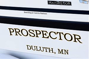
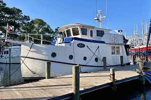
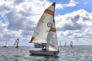
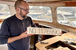
Marcel Lafond and SV Prospector:

Searching for Gold and Platinum. The Shipping News
July 2026 Town Board Meeting:

A budget is approved. The Story
Letters: An Intent to Retire:

Looking to the future. Letters To The Editor
CroakerFest 2026:

Celebrating 250 years. The Story
Letters: Clearing up Questions:

With thanks & carry on. Letters To The Editor
Thirteen Years of Silospalooza 2026:

Cajun Zydeco headlines festival . The Story
June 2026 Town Board Meeting:

Budget Hearing continued, and a tree comes down. The Story
Letters: Pecan Tree Stalemate:
Two paths forward. Letters To The Editor
The Pig Celebrates 10 Years:

A decade serving Oriental. The Story
May 2026 Town Board Meeting:

Town welcomes new officer. The Story
NOAA's Prediction: A Below Average Hurricane Season:

But will a storm visit here?. The Story
Sara's Last Sail:

A boating equivalent to organ donation. Captain's Blog
Letters: Reevaluate Property Tax Revaluations:

Revaluation data inconsistent, inaccurate. Letters To The Editor
From Argentina to Whortonsville:

Zonda Group finds a home near Oriental. The Shipping News
Letters: Thanks from the Oriental Rotary Club:

Grateful for the community support, proud of the difference we make. Letters To The Editor
Cycle NC 2026:

Over a thousand cyclists visit Oriental. The Story
April Town Board Meeting 2026:
Pickleball court placement settled, volunteers needed. The Story
Zac Schnell, AI and Community Engagement:

A New Path for Pamlico Community College. The Story
The 2026 Oriental In-Water Boat Show:

Power boats, sailboats and a beer garden. The Story
Eston “Sherrill” Styron, 1942 - 2026:

Husband, Father, Friend and Mayor. The Story
Capsizing on the Creeks: SailPack 2026:
19 teams converge on Oriental. The Story
Letters: SailPack Regatta - Thanks To A Sailing Town:
Friendship, generosity, and hospitality. Letters To The Editor
Letters: Thanks From the Ragan Family:

Grateful for the community support. Letters To The Editor
2026 PAWS Pet Parade:

168 canine legs strut their stuff. The Story
Letters: Thank You Oriental:

Gratitude from the family of Russ Stevenson. Letters To The Editor
Weekend Preview: Sailpack 2026:

The 10th Annual Sailpack Oriental Intercollegiate Regatta returns to Oriental. Guest Columnist
The Dragon Burn That Didn't:
Live Music, Chinese Dragons, and a Fire Dancer. The Story
James "Jimmy" Edward Ragan, III, 1941 - 2026:

Judge, storyteller, civic leader. The Story
Letters: Leave Lupton Park Alone:

Neighbor says expansion will benefit few. Letters To The Editor
March Town Board Meeting 2026:
Special Use Permits, unauthorized expenses, and dog dirt. The Story
Loblolly Pines & Pollen:

It's trees in love. The Story
Luna the Catamaran Cat:
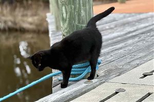
A cool cat at Marine Craft. Pet Of The Month
Letters: Working To Restore Hodges Street:

Commissioner Says Thanks. Letters To The Editor
Russell "Russ" Bryan Stevenson, 1932 - 2026:

"Notorious in the best small town way". The Story
Town Board Acts Fast in Fight for Funds:

Congressman Don Davis visits Oriental. The Story
February Town Board Meeting 2026:
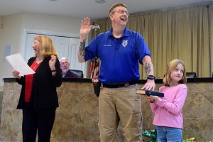
Property fraud alert, new Chief of Police sworn in. The Story
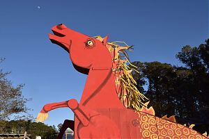
2026 Chinese New Year:

Year of the Fire Horse. The Story
Mads and SV Spiffy:
YouTube DIYer tackles new project in Oriental. The Shipping News
Michael Edward North, 1950-2025:

Husband, loving family man, outdoorsman, US Marine. The Story
Letters: Thank you for your Kindness:

A request answered. Letters To The Editor
January Town Board Meeting & Workshop:
A new Police Chief is named. The Story
Letters: In Praise of Neighbors:

Community arrives with help. Letters To The Editor
Oriental Snow Days:
Pictures from the February snow storm. The Story
Katy Burke & Taz Waller:

Two people, three boats, nine homes, four decades. The Story
Winter Canvas Tips:

Boat canvas & winter weather. Canvas Corner
Instead of Football Regatta 2026:

32 years of a New Year's tradition. The Story
Friends Of The Dragon 2026:

It takes a village to house a dragon. The Story
Cathy Sue Brugett, 1954-2025:

TV host, sailor, wife, daughter, volunteer. The Story
December 2025 Town Board Meeting:

New board sets a positive tone. The Story
The Spirit of Christmas 2025:

Five Grinches, grits, and a polar bear. The Story
2025 Spirit of Christmas Schedule:

What's happening, where and when. The Story
Mary Watson Duffie, 1938-2025:

Teacher, musician, wife & mother. The Story
November 2025 Town Board Meeting:

Road repair fund set, green bin dumper busted. The Story
Turkey Pedal 2025:

Pedaling to earn their dinner. The Story
Giving Locally 2025:

Area Non-Profits That Could Use Your Donations. The Story
David George Wright, 1949-2025:

Husband, father, sailor, proud grandfather. The Story
2025 Oriental Cup Regatta Results:

Oriental Express 1st Spinnaker, Il Gatto 1st JAM. The Story
Dredging Starts Soon:

A new route for Whittaker Creek Channel. Guest Columnist
Election Results 2025:

Jordan, Moffat, Cooper, Ostendorff and McGuire elected. The Story
Chili Cookoff 2025:

Twelve chilis for 300 tasters. The Story
Oriental Candidates' Forum 2025:

Nine contenders speak to a packed house. The Story
Letters: We Will Still Be Neighbors:

Looking forward. Letters To The Editor
October 2025 Town Board Meeting:

Robert's Rules Of Order restored. The Story
A History of Sailmaking in Oriental:

Making Sails in North Carolina's Sailing Capital. The Story
Meet the 2025 Oriental Town Board Candidates:

Eleven candidates for five seats. The Story
Sharon Rose Howard, 1938 - 2025:

Mother, teacher, friend. The Story
George Hughes Beckwith, Jr. 1970-2025:

Outdoorsman, Storyteller, Husband. The Story
Ol' Front Porch Music Festival 2025:

Two perfect days draw a crowd. The Story
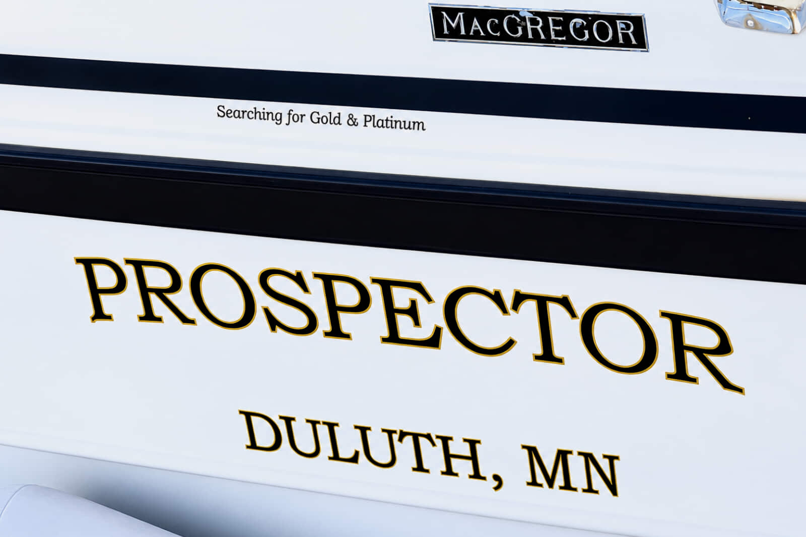
In Looper terms, “Gold” means you’ve completed one loop, “Platinum” means you’ve completed two Loops. SV Prospector visited Oriental this spring, working on that first Loop. Meet Marcel Lafond onboard SV Prospector, in The Shipping News.
3:03p Happy weekend. Highs forecast to stay just below the 90s.
 Tonight at the Red Rooster, Mike Bramble starts up at 7. At the brewery, Ken Belangia in the beer garden, while the Taqueria San Luis food truck serves.
Mariposa is closed this weekend Aug 1-3 (back in action Sat Aug 8). Broad Stokes Gallery presents the August Artist of the Month: John & Dodi Grosser and Student Artist Baileigh Jones. Meet the Artists Saturday 2-5p at the gallery. At New Village Brewery, Shawn Aldridge plays the beer garden, while All About Churros food truck serves.
Sunday morning, there’s riverside church service 8:30a at Lou Mac park. Uncle Mann’s Food Emporium truck at the brewery Sunday 2-6p.
It’s all in What’s Happening.
10:01a Marcel Lafond visited Oriental on his way through the Great Loop. His Loop trip almost didn’t happen; he was diagnosed with Parkinson’s Disease in 2020.
A brain implant changed his prognosis, and now the boat designer is mapping out his second Loop while still finishing his first.
Learn more about Marcel and his MacGregor 26 Prospector in The Shipping News.
10:10a: Tonight, meet the folks who protect the waters of the Neuse and Tar-Pamlico Rivers: the Sound Rivers Riverkeepers. 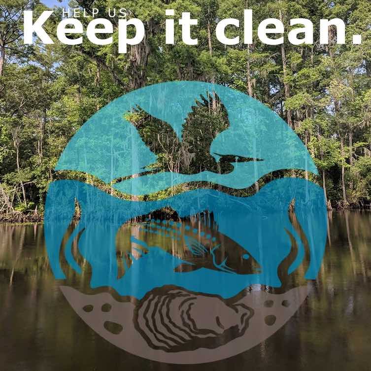
Presented by the Oriental History Museum, the presentation will be at The Old Theater at 6:30p.
Find out about the history of Sound Rivers, how the Riverkeepers work at the local and state level to keep it clean, and the work they carry out after incidents, floods, and storms.
This is a free event, donations are always welcome. Presentation is followed by a Q&A. Doors open at 6p.
Capone’s A Taste of Philly is at the Brewery tonight, 4-8p.
12:37p It’s a new week, and Salty Celeste delivers up Pet Horoscopes.
There’s daily horoscopes for you human readers, too.
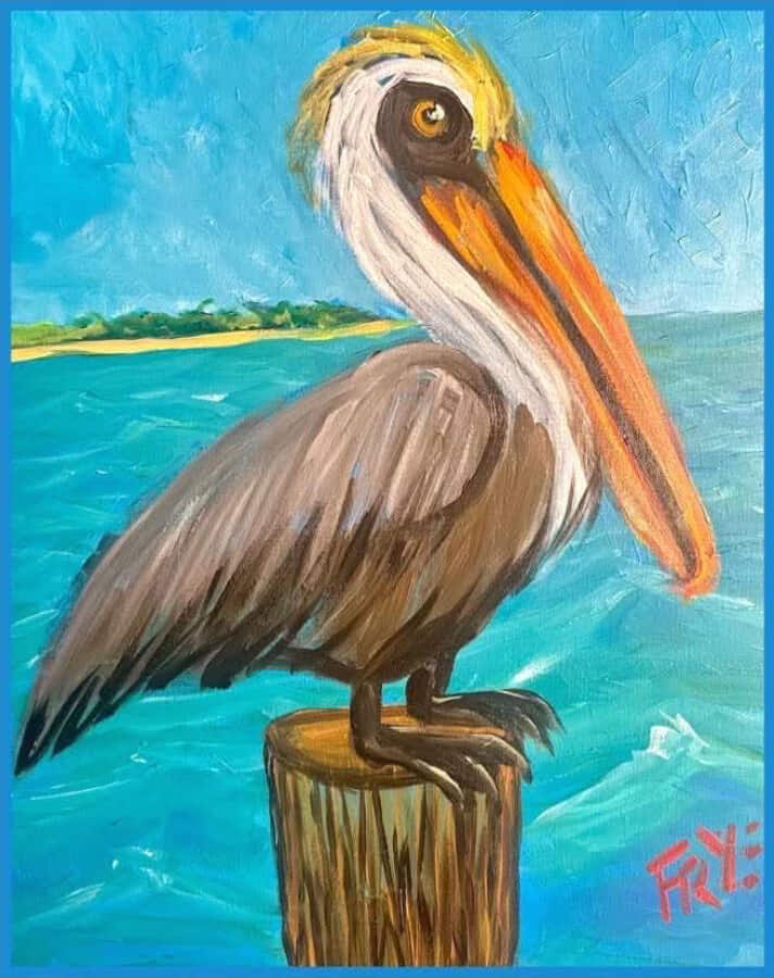 10:01a Artist Charlie Frye invites y’all to painting class at Nautical Wheelers, Tuesday 4-6p. Charlie will lead and inspire you to paint a pelican, while the Wheelers keep pouring wine. Read on…
9:18a High in the mid 80s and no high heat index in sight. Given July’s hot, rainy weather so far – today is down right pleasant.
There is a chance for rain later on, but the rest of the week looks (comparatively) manageable with temps near 90.
Out on the Neuse, winds are out of the south at 5-10 knots. Chance of showers and thunderstorms this afternoon and evening.
• Oriental NC Forecast
• Neuse River Marine Forecast
• Oriental Water Level Gauge
• Oriental Weather Station
1:45p It may be wet, but no cause for whining at today’s wine tastings @ Nautical Wheelers. They go on, dry and happy under the carport.
10:22a The Charity Dinghy Poker Run is still on – just without the dinghies (adapting to today’s weather). 
Head over to the Tiki Bar and get your ‘land hand’; $10 per hand or 3 hands for $25.
Check out the ongoing Silent Auction under the tents, and grab a free lunch (with purchase of poker hand) courtesy of the Rotary Club.
Hands are on sale until about 1230 – 1p. Bid on the live auction at 1:30p.
The Dinghy Poker Run is fundraiser put on by Oriental’s Nautical Collective of Sailing Clubs. Proceeds benefit Pamlico youth sailing, swimming lessons and nautical activities.
4:21p Yes, it’s raining. And yes, it will rain tomorrow. Don’t let that stop you from enjoying the weekend; it will be hot again soon enough.
There’s a new food truck at the Brewery tonight: Thai Street Bites, 4-8p.
Saturday, it’s the 19th Annual Charity Dingy Poker Run. It’s starts at the Tiki Deck. Poker hands go on sale at 9:30a, the Run begins at 11a. You don’t have to have a boat to play. The Run is happening rain, or shine; dress appropriately.
Join Nautical Wheelers at 2 & 3p for a wine tasting with Andy Woolger of Elephant Corner Wines.
Taqueria San Luis is at the Brewery, 4-8 and Ken Belangia plays 6:30-8p.
OUMC holds their Lou Mac Park Riverside service at 8:30a Sunday. At the Brewery, it’s Sunday Funday Field Day, 3-6.
It’s the last week of Broad Strokes’ Gallery’s exhibit The Medicine of Beauty, Saturday 10a-5p, Sunday 11a-4p. Visit Oriental History Museum for their exhibit about the Neuse: Rollin’ on the River.
Mariposa has fresh baked goods Saturday, Sunday, & Monday 7-11a, and charcuterie & wine flights in the evenings, 3-9p.
 The Sound Rivers Swim Guide tests local waters for bacteria and lets you know whether or not those waters are safe for swimming. This week, five sites failed. Once of them is Pierce Creek in Oriental.
Click here for the Swim Guide press release.
3:32p If you need a Rotary tent, the normal phone # is out. The Oriental Rotary Club writes in:
In the meantime, to arrange for a rental, please contact us at orientalrotaryclub@gmail.com.
7:25a Keith Bruno is the owner of Endurance Seafood, located just over the Oriental Bridge. He lives and works on the Neuse River.
TownDock.net interviewed him back in 2020. Take a look:
Meet Keith tonight at the Oriental History Museum, 802 Broad St. The event is free and starts promptly at 6:30p.
12:35p  July’s monthly Town Board meeting saw a budget passed and seven new members appointed to the Tourism Board, heard about plans for road paving, and discussed the Town’s response to a CAMA permit request for a 600 foot dock in Oriental’s harbor.
The full July meeting report is here.
It’s currently 88 degrees with SW winds at 15-20 mph, gusts up to 30 mph. Despite that, a heat advisory is still in effect until 7p tonight: heat index values could be as high as 108.
6:01a Diane Miller has served as Oriental’s Town Manager since 2014.
Tuesday morning, Miller sent Commissioners a letter of intent regarding her retirement.
That evening, she sent one to TownDock.net. Read it here.
4:11p A golf cart was borrowed last night. It actually was sorta returned, but Chief Bill with the Oriental Police Dept is requesting help:
If you recognize these individuals or have any information that may assist our investigation, please contact the Oriental Police Department at 252-772-3092.
We appreciate the community’s assistance as we work to gather information regarding this incident. Thank you.
8:51a Heat index is forecast to be up to 102 later today, but as of this writing, it’s a pleasant (and not too humid) 79 degrees.
Rain is likely with us all week with thunderstorms predicted at weeks’ end:
Pamlico County has their second monthly board meeting this evening at 7p.
Earlier this month, PAWS (the Pamlico Animal Welfare Society), held their monthly Pet Food Pantry at Pamlico Library. 
The Pantry is a donation-based service for Pamlico pet owners who find themselves in need. It was so successful, they ran out of food halfway through the event.
They’re asking for donations of dog or cat food, and cat litter. Drop-off is at the Pamlico County Library circulation desk, either in person or by mail.
4:30p The heat index is in the 107-113 range today and Saturday, Sunday has a near 90% chance of rain. 
All About Churros is at the Brewery, 4:30-8p and NottaDuo plays in the garden, 6-8:30p.
Shawn Aldridge is at the Red Rooster Pavilion behind The Silos at 7p.
Spend Saturday morning at the Farmer’s Market on Hodges Street, 8-11a. Shred your documents at the Bayboro Courthouse, 9a-noon. Join a wine tasting at Nautical Wheelers at 2 & 3p.
Stop by the Oriental History Museum for their new exhibition about the Neuse River, 1-4p.
Mariposa has brought back sausage rolls and homemade focaccia bread this weekend. Get your fresh baked goods Saturday, Sunday, & Monday 7-11a, and charcuterie & wine flights in the evenings, 3-9p.
Wander through Broad Strokes’ July’s exhibition The Medicine of Beauty, Saturday 10a-5p, Sunday 11a-4p.
Join OUMC by the river at Lou Mac Park for Sunday riverside services at 8:30a. If it rains, everyone heads inside the sanctuary just down the street.
It’s all in What’s Happening.
12:04p Filing for local elections closed today at noon.
Your declared candidates for Oriental are:
• For Mayor: Sally Belangia
• For Commissioner: Don McGuire, Iris Cooper, Lou Ostendorff, Paul Jordan and Charlie Overcash.
That’s five declared candidates for five seats, resulting in an uncontested election for Oriental this November.
12:31p TownDock.net reached out to Commissioner Chris Moffat to see if he will be running again. From Commissioner Moffat:
I trust and respect Commissioners Jordan, Cooper, McGuire and Ostendorff. They are committed to the Town and will continue to do good work in an open, positive manner.
The addition of former Commissioner Overcash is a huge positive. I wholeheartedly support all five of them. I plan to re-retire and focus on family, travel, time at the beach and my health. Thank you to the citizens of Oriental for the opportunity to serve.
9:49a  A familiar face has signed up to run for Oriental Town Commissioner: Charlie Overcash.
Currently, there are five declared candidates for Oriental’s five Commissioner seats: Paul Jordon, Lou Ostendorff, Iris Cooper, Dan McGuire and now Charlie Overcash.
Sally Belangia is the only candidate for Mayor.
The Oriental History Museum’s Evening Summer Speaker series begin this evening with local photographer Ben Casey.
Tonight’s presentation features photography from Ben’s trip on the Neuse River from Raleigh to Pamlico Sound. Admission is free. Begins at 6:30p at the Oriental History Museum on Broad St.
9:44a At last night’s Oriental Town Board meeting, Commissioners passed a budget, appointed seven new members to the Tourism Board and one to the Planning Board, and detailed their meeting with a street paver and the next steps to make that happen. 
A full report is coming.
They also increased the frequency of the town’s mosquito spraying. Spray trucks will be out this Friday, then begin spraying on Tuesdays and Thursdays. Spraying starts at 5:30a and runs until about 7:30a.
Want your property to be excluded from spraying? Contact Town Hall and ask to be added to the list. 252-249-0555
El Taco Loco is serving at Triton Yachts boatyard, starting at 11a.
11:36a Yesterday, 2.73 inches of rain fell on Oriental. There’s a slight chance of more this afternoon.
Temps in the low to mid 80s this afternoon, then back to 90-degree weather for the rest of the week.
Tonight is Oriental’s monthly Town Board Meeting. The Public Hearing on the 2026-27 fiscal year budget continues at tonight’s meeting.
Also on the agenda: CAMA asks for the Town’s response to an application by Fulcher’s Point Pride Seafood to build a dock parallel to the harbor jetty, extending several hundred feet.
There have been no new applications for Mayor or Commissioner submitted to the Board of Elections since last week. The candidates so far are Sally Belangia, Lou Ostendorff, Iris Cooper, Don McGuire and Paul Jordan. The filing deadline is noon Friday.
7:08a It rained for a good part of the early morning. Nearly an inch and a half of so far. There’s more in the forecast for today and tomorrow.
Good news is the high temperature will be near 80, near 85 Tuesday.
Winds are east at 10-15 mph, gusts up to 25.
Both Mariposa and The Bean are open for rainy weather coffee contemplation. 
Later this afternoon, the One-Off BookClub meets at the Perry Griffen house.
Nice thing is, you don’t have to read the book. You’re invited show up and enjoy the conversation.
They’re currently reading The Artist’s Rule by Christine Valtners Painter, supplemented with Seven Thousand Ways to Listen by Mark Nepo.
3:27p Filing is open for local elections. For Oriental, the following incumbents have signed up:
Sally Belangia (mayor)
Paul Jordan (commissioner)
Iris Cooper (commissioner)
Don McGuire (commissioner)
Lou Ostendorff (commissioner)
Last day to sign up is Friday, July 17 at noon.
Looking for last weekend’s Croaker Festival photos? Find them here.
There’s rain in the weekend forecast, with the highest chance (70%) hitting on Sunday. Temps will be near 90 Saturday and mid 80s Sunday.
Ken Belangia plays at the Brewery tonight, 6-8:30p and A Taste of Philly is serving, 5-8p. Down at the Red Rooster, Magazine Street Dave starts playing at 7p.
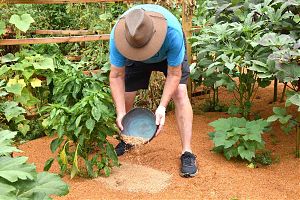
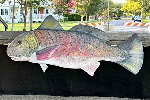
Catch a drum and win some cash Saturday during the Volunteer Fire Department’s 2026 Hooks & Ladders Drum Fishing Tournament, 6a-3p.
Get fresh produce, flowers and more at the Oriental Farmer’s Market Saturday morning on Hodges street until 11a. Stop by the Oriental History Museum for their new exhibition Rollin’ on the River.
Meet Broad Strokes’ July Artist Susan Cheatham Saturday, 2-p and explore July’s exhibition The Medicine of Beauty.
Stop by the Library to donate or pick up from the Pet Food Pantry, 10a-2p. 
Head over to Station 19 to find out the Fishing Tournament winners, take a tour of the fire station, and meet some of your local firefighters. The Open House starts at 5p.
Jasmine Tasty Thai is at the Brewery, 4-8p and Brant Island Strings play in the Beer Garden, 6-8:30p.
Join OUMC for river side services at Lou Mac Park on Sunday at 8:30a. If it rains, everyone heads inside the sanctuary just down the street.
Uncle Mann’s Food Emporium is at the Brewery 2-6p. Dress up and join the Princess Bride trivia and costume contest at 3p.
Mariposa serves fresh baked goods Saturday, Sunday, & Monday 7-11a, and charcuterie & wine flights in the evenings, 3-9p. On offer this weekend: a selection of white wines and sangrias.
It’s all in What’s Happening.
6:10a Thursday morning, Mary Yount came across an elusive Oriental resident sunning on the town’s free dock. Take a look:
Need a little help feeding your pet? Or want to donate to a worthy cause?
4PAWS, Friends of the Library and Pamlico Animal Welfare Society have created the Pamlico Pet Food Pantry, for county residents in need of pet food or litter.
They’re open on the second Saturday of the month, at the Pamlico Library, 10a-2p. Find out more, including how to donate, here.
A heat advisory is still in effect today. Highs in the mid 90s, heat index up to 106. Winds are from the west at 5-10mph.
3:55p  Pamlico County’s property tax reappraisals will have to wait a fiscal year to go into effect.
SB 474 was signed by Governor Josh Stein this past Tuesday. It adds Pamlico County back onto the original moratorium bill. That bill was passed, and it freezes the current revaluation rate. The County will have to use the last fiscal year’s rates for 2026.
Now that Pamlico County has been added back in, residents have time to get an appraisal and appeal their property revaluation.
The full text of SB 474 is here.
Uncle Mann’s Food Emporium is at the Brewery tonight, 4-8p. The Gathering is 6p at The Bean.
2:07p Federal and state elections are just a few months ahead: November 2026.  Joining them on the ballot are Oriental’s races for mayor and commissioner.
A previous board made the controversial vote to move municipal elections to even years, coinciding with partisan state and federal elections.
The result is that current Commissioners are in the seventh month of their shortened, one-year term. If they want to stay in office, they must run again.
Filing is happening now at the Pamlico County courthouse. Interested parties have until Friday, July 17 at noon to submit their application and filing fee to the Pamlico Board of Elections.
All who have filed so far are incumbents. Here are the names:
Sally Belangia (mayor)
Paul Jordan (commissioner)
Iris Cooper (commissioner)
Don McGuire (commissioner)
Sign up to help a good cause – and maybe win $1,000.
Join 2026 Hooks & Ladders Drum Fishing Tournament on July 11, 6a-3p. Win cash prizes for 1st, 2nd, & 3rd place. Tournament details are here.
Tournament benefits the Southeast Pamlico VFD & EMS.
Awards happen that evening at the Station 19 Open House & Cookout fundraiser. You don’t have to go fishing to attend the Open House.
Miscellaneous items
Price Reduced: Cottage - Private Boat Ramp & Dock
Computer Repair, Service and Education
1973 Columbia 34' For Sale
NICE 1993 26S Macgregor for sale
New Sunfish Sailboats
Water Front 2 bedroom 1 bath cottage for rent
2019 Subaru Forester Touring
Upright Freezer
40 ft Boat Slip for Rent or Sale - Oriental $375/$29,500
Boat Trailer
Electric Small Boat or Jet Ski Lift
Recent cover photos: