It's Wednesday May 6, 2026
May 15, 2018
When the winds blow hard enough from the north & northeast, Hodges St. floods at the harbor. It’s a common enough occurance that TownDock.net often posts a notice to break out your Pamlico Nikes when the winds come from the north.It’s been going on for a while. There are records of the Oriental Women’s Club meeting with the Town Board in 1964 to discuss raising the road.
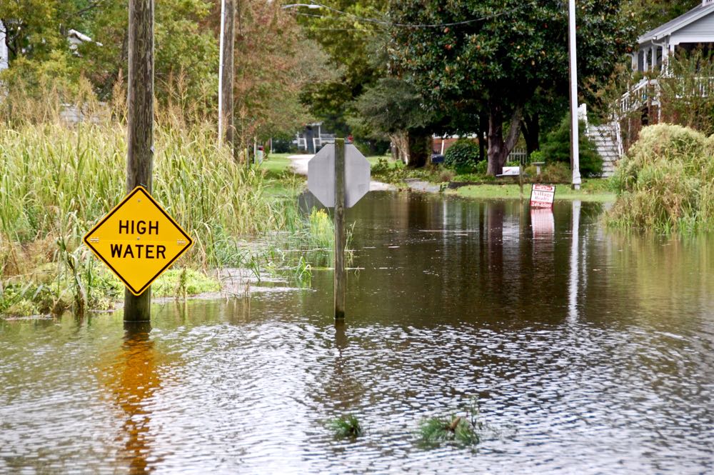
Living along the river, residents expect the Neuse to overflow its banks during hurricanes and large storms. But the frequency of flooding is increasing, and it doesn’t take a hurricane like Irene to push the river into Oriental.
Main St. in the wake of Hurricane Matthew, October 2016.And it’s not just Oriental. “Sunny day flooding”, also called nuisance flooding, is happening throughout North Carolina, rerouting traffic and regularly swamping residential and municipal land in coastal towns. A few inches of water doesn’t seem like much, especially when compared with the destruction hurricanes can cause. Yet that small amount of water on a regular basis damages town infrastructures and can strain maintenance budgets.
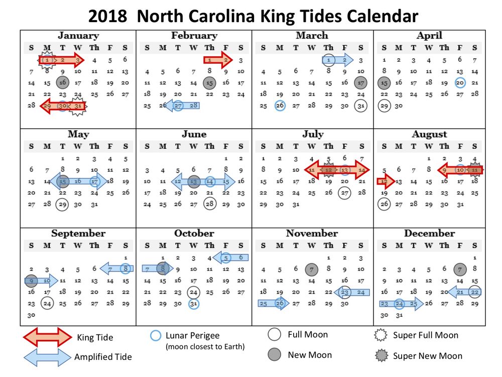
This is where the NC King Tides Project comes in. King tide is a non-scientific term for the highest high tide – a perigean spring tide. It describes the period of time when the moon is closest to the earth (at perigee) during a spring tide (a new or full moon). When the moon’s perigee and the spring tide are offset by a day or more, it is known as an amplified tide. King tides and amplified tides are predictable events, occurring several times a year, causing the higher high tides and lower low tides.
The King Tides calendar for 2018 showing the regularity of the king and amplified tides.In decades past, floods might occur a few times a year. Now, flooding happens frequently along the North Carolina coast. The project seems counterintuitive for Oriental – tides here are wind driven and a southwest wind can create extreme low tides. But researchers are interested in that, too. They want data collection, particularly pictures, of the interesting events – the highs and the lows that happen throughout the year, especially as sea levels are rising globally.
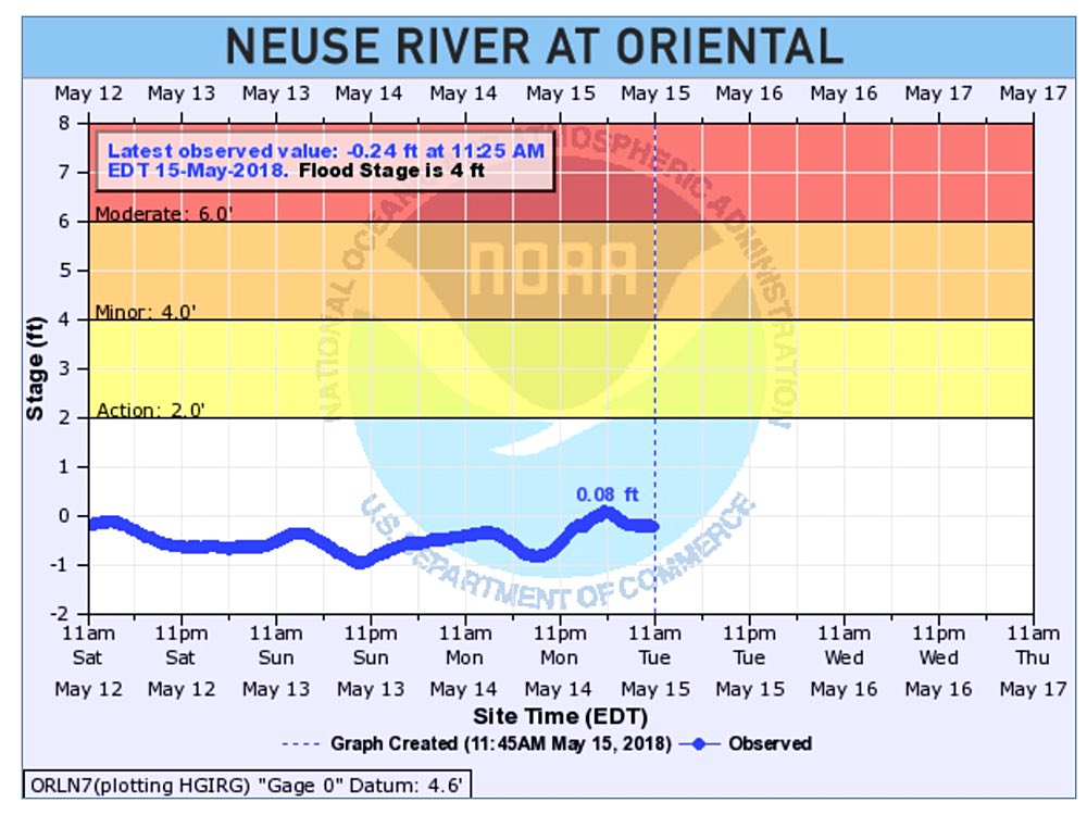
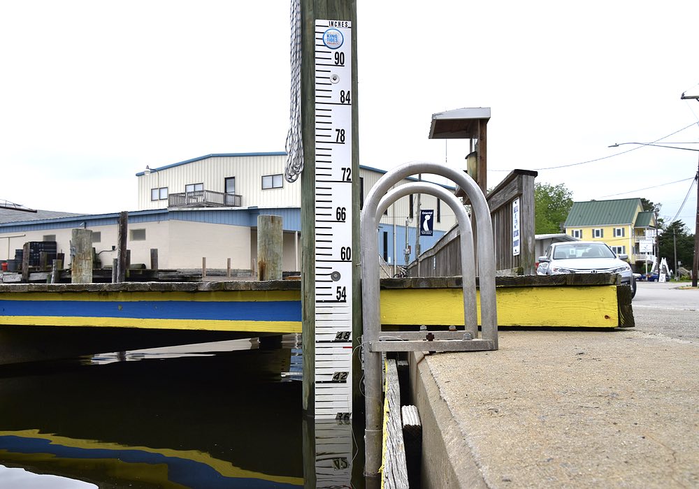
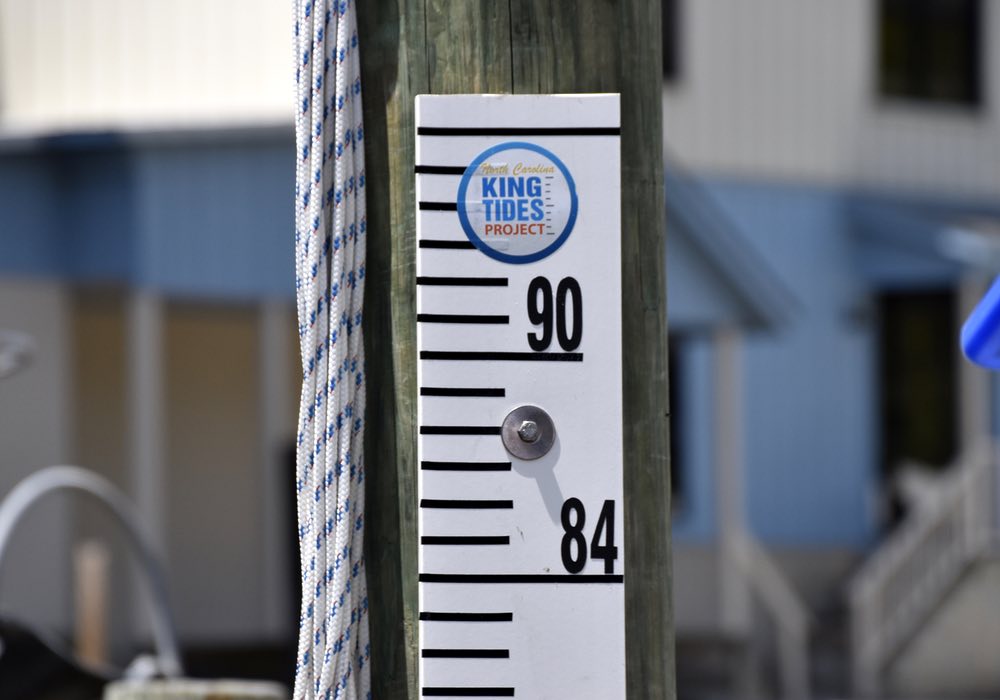
TownDock.net uses data from the NC Division of Emergency Management to track water levels in the Neuse.Marygrace Rowe and Chris Voss, researchers with the UNC Chapel Hill Institute of Marine Sciences, were in town recently to install a water level staff at town dock 1 and talk about the project. Rowe said the NC King Tides project is “part of an international initiative to photo document water levels, specifically higher water level events which are those King Tide events that can cause nuisance flooding in waterfront areas.”
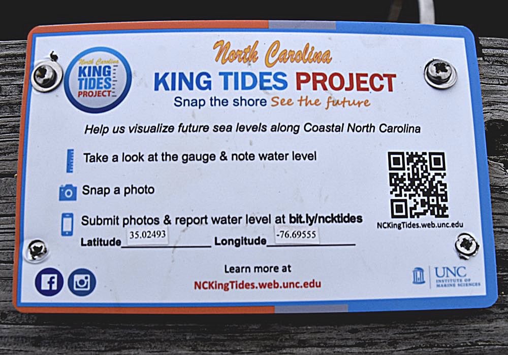
The water gauge at town dock 1. The Red line marks the curb of the street.A plaque mounted on the rail near the staff describes how to document the level changes and send in data. Cell phones, and the help of the public, are what make the project work. “We’re kind of using these photographs as a means to prepare people and get people thinking about sea level rise and how it’s going to look in North Carolina.” That is the biggest difference between this project and more high-tech gauges around the state. The pictures collected by residents provide a visual reference point of what a six inch or 1 foot rise in sea level would mean for existing communities.
How to collect and send data to the King Tides project.Rowe and Voss want your pictures of the water levels around town – whether it flows over the road or barely covers the duck pond. Voss said the data, “goes to a NOAA [National Oceanic and Atmospheric Administration] app, directly to an online database and it’s entered in real time.” All collected data for any given gauge can be accessed through the What’s Your Water Level app.
The project depends on the help of ‘citizen scientists’. Stan Aeschelman, chair of the planning board, has volunteered his time. Rowe contacted the town and Aeschelman responded. It was an interesting idea, but Oriental already had one highly accurate data recording device. Aeschleman wanted to know why it needed this one.
Chris Voss explains perigean tides while Marygrace Rowe and Stan Aeschleman go over the reporting procedure.“Even though that instrument [the gauge at Lou Mac Park] is more accurate than me going out and eyeballing it, they ask that we continue to participate for two reasons,” he said. “One, it will show how good the human reading is relative to the more precise instrument, which will give them some idea of how accurate the other gauges are in other locations; so it’s a reliability check. And then secondly, they’re trying to publicize – make citizens aware – of water levels.”
Aeschleman believes there are other benefits for Oriental. “I thought it would be a nice way for Oriental to connect with other coastal communities. If we want to write a grant at some point, for whatever reason, I think the more connections we have with valid scientific organizations, the better off we are.” Currently, the town board is investigating grants to preserve Whittaker Point from further erosion and at methods mitigating the flooding of Hodges St. and the area around the duck pond.
The water gauge at town dock 1.Aeschleman has volunteered to take a reading when walking his dogs by the harbor. That’s one reading a day. One a day is fine, but the project can always use more.
“This QR code will take you straight to our website, “Rowe explained. “You’ll see a button that says submit a photo or report and you click that, it will take you straight to a little form you fill out. You can upload a picture. There’s a place for you to put the water level. And it’s less than five minutes.”
For more information about the project, king tides, coastal flooding in North Carolina, or archived articles of past flooding events, click the links below.
Related Links
North Carolina King Tides Project
What’s Your Water Level
Hodges Street Flooding. Is There a Fix?
In Matthew’s Wake
Hurricane Irene – TownDock.net coverage
Sea Level Rise Viewer
When Rising Seas Hit Home: An Analysis by the Union of Concerned Scientists