It's Saturday May 30, 2026 Dock Quote: “Magnetism, as you...

Readers have been calling and writing in with questions about surge.The questions are variations on “My place flooded during Irene & Florence – will Isaias be the same?”
It’s a good question.
What Surge MeansThe surge numbers you see and hear about are about normal water levels, NOT water levels above ground. So for example 3 ft of surge does not mean 3 ft of water in your living room. It means 3 ft above normal water levels. Normal? The level water typically in the harbor is a good example.
What Causes SurgeSurge / high waters in Oriental are predominantly caused by high north, northeast and east winds on the Pamlico Sound and Neuse River. Sound waters get pushed south into the Neuse. All that water has to go somewhere – and that somewhere is up; water levels rise.If the tropical storm passes to our east, we get those north winds. For example, Hurricane Florence in 2018. Hours and hours of hurricane force north winds had Florence deliver a 9 1/2 ft surge to Oriental.
All of the serious flood storms (Isabel, Irene, Florence) have passed to our east.
Isaias has a very different forecast track. Tropical Storm/Hurricane Isaias is forecast to pass to our west.
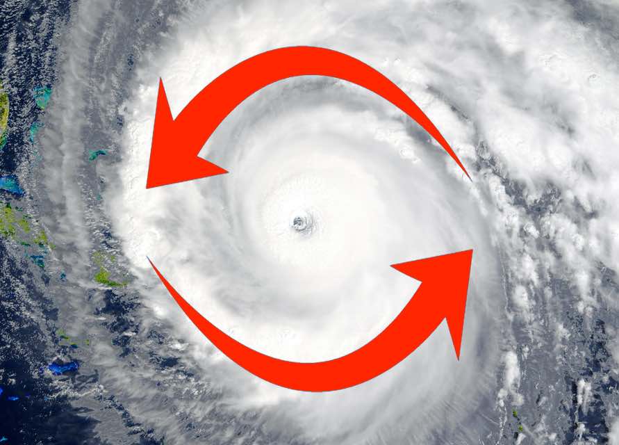
A hurricane or tropical storm’s winds are counter-clockwise.When a hurricane or tropical storm passes to our west, we get the opposite wind conditions from when one passes to our east. This means we will predominantly see south and southwest winds from the storm. They don’t make water rise in our area, they do the opposite.
South, southwest & west winds cause the opposite of surge – popularly termed at TownDock HQ as “suck”. Water levels would actually go down, because those south/southwest winds will push water north into the Pamlico Sound – away from our area.
Why Are There Different Surge PredictionsThat’s a good questions, for which we may have no good answer.NHC (National Hurricane Center) typically predicts surge in very general terms. This forecast follows that. NHC predicts for storm Isaias 2-4 ft of potential surge for for the entire NC coast, Pamlico & Albemarle Sounds plus the Bay and Neuse River.
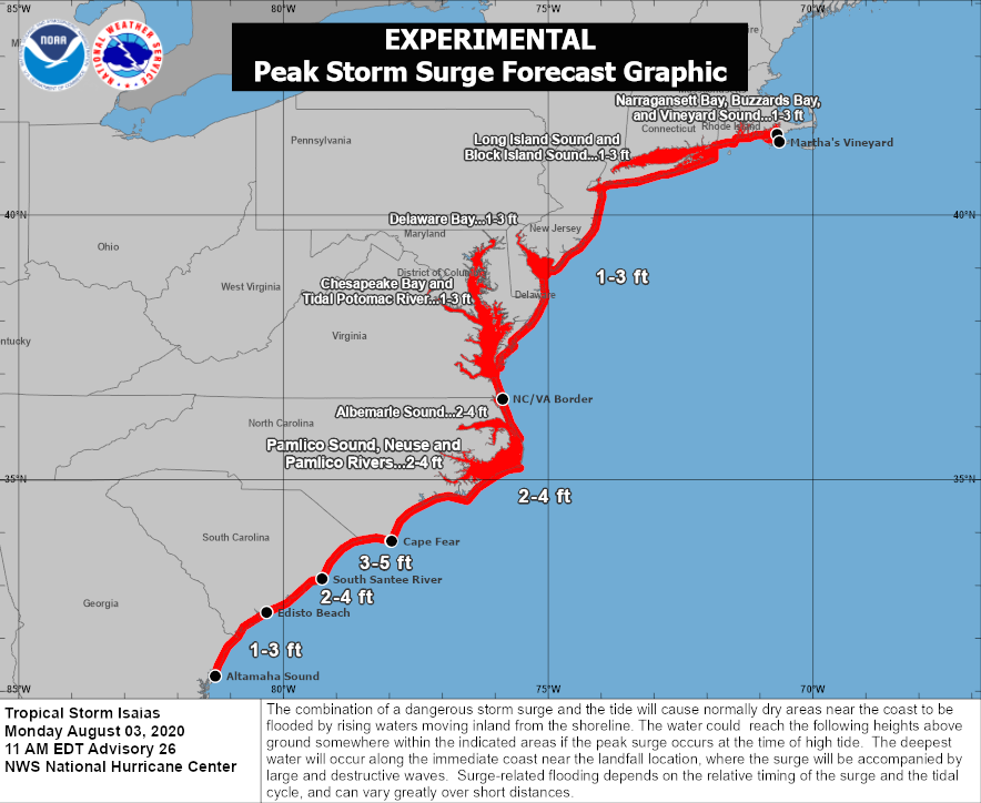
All these places won’t get the same surge. The reality? In some locations the water will go up. Some, it goes down.
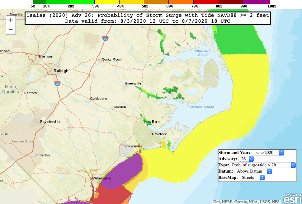
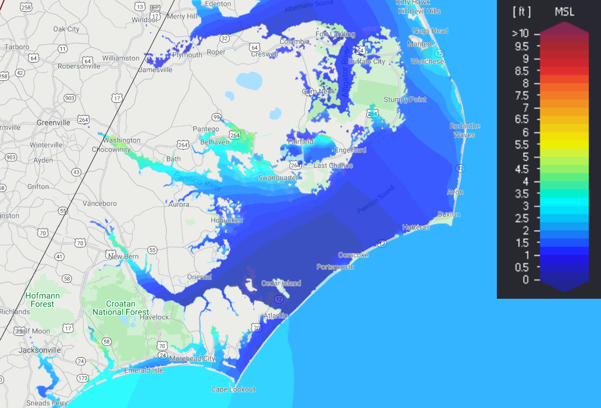
This map is from CERA – it bills itself as Storm Surge Guidance for Emergency Managers and Decision Makers. It shows levels above MSL – Mean Sea Level. This should be close to how we have measured peak levels in the past.
CERA is a collaboration of several universities.
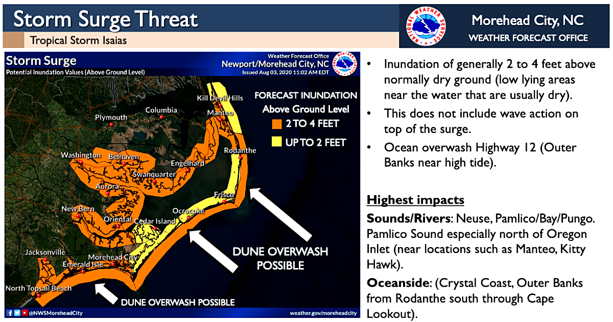
 From what source NOAA Newport NC created this is unclear. It suggests 2-4 feet of water above ground, everywhere in orange. All other sources suggest this will not happen, as does a knowledge of how surge works in eastern NC. NOAA/NHC has a separate inundation model on the NHC site. It shows no inundation at these locations.