
It's Wednesday June 24, 2026
October 24, 2013
NOAA, the National Oceanic and Atmospheric Administration announced this week that as of mid-April next year the Federal government will no longer print its lithographic nautical charts.The century and a half tradition of government-printed charts comes to an end because of budget constraints — NOAA sold the charts for what it cost to print them — and because more and more mariners were using digital and electronic charts.
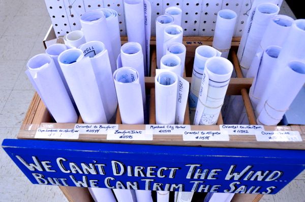 Rolls of charts for sale at the Inland Waterway Provision Company. Most of them are already printed by a private company certified by NOAA, which can print them with more updated information than the ones printed by the federal government. The government’s decision to cease printing might be seen as a version of trimming its sails to adapt, and offer the chart information in other ways.
Sailors have been making the move away from the government printed charts for some time. At the Inland Waterway Provision Company in Oriental, Manager Pat Stockwell says that he’s noticed that most sailors looking for navigation charts buy waterproofed versions sold by private companies.
In an interview with TownDock.net, Dawn Forsythe, a spokeswoman with NOAA’s Office of Coast Survey says that NOAA will continue to update charts — just not print lithographic copies, a job that was actually done by the Federal Aviation Administration on behalf of NOAA. The FAA will stop the presses on nautical charts on April 13, 2014.
Charts will still be available, just not from the government presses.
Printing On DemandIn a statement issued Tuesday, NOAA said that its lithographic charts would still be available as Print on Demand (POD) through two companies that were “NOAA-certified.”
On Wednesday, NOAA’s OCS spokeswoman said that since NOAA’s Tuesday announcement a half dozen other companies have said they would also like to be on that list of NOAA-certified POD providers.
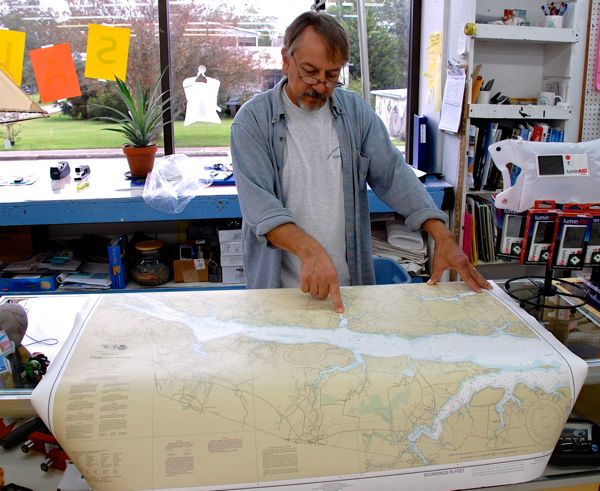 A chart of the Pamlico River, as laid out on the counter of the Inland Waterway Provision Company. The large format charts – almost 4 feet wide – have been fading in popularity as many boaters choose electronic navigation and booklets instead. Now the government’s getting out of the nautical chart printing business.
One criteria for being NOAA-certified, says Dawn Forsythe, is that the POD company cannot charge more than $29.50 for the basic POD chart. The POD providers also have to pay NOAA fifty cents for every POD order that’s fulfilled.
Consumers can order the POD’s directly on line or buy them through a retailer. Most of the large scale charts sold at the Provision Company in recent years are ones that were printed by the company Ocean Grafix. The store has only a few of the older Government printed charts available for sale.
 A chart of the Neuse River for sale at the Provision Company was printed this year by Ocean Grafix, an on-demand company in St. Paul, Minnesota that is one of two NOAA-certified printers.
The advantage of the POD charts, Forsythe says, is that the information is much more updated than that on the charts that the federal government has been printing and sending to stores to sell.
Some of those paper charts now on sale in stores could have information that is up to a decade old. Fowler says it depended on the area of the chart. Some were updated yearly, while others might see ten years lapse between updated printings.
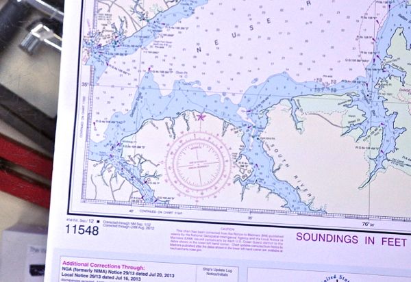 Chart 11548 – Pamlico Sound Western Part – printed by the private company, OceanGrafix. As noted in the left corner, it includes updates from as recently as this summer. OceanGrafix and one other company are NOAA-certified to print the charts now that the government is getting out of that business, in part because it found it too expensive to print the updated charts itself. Other companies are also looking to get in on the printing-on-demand business.
Forsythe says NOAA would typically “wait until there were close to 100 changes” to be made to a chart before that new version was sent to the FAA print shop.
By contrast, she says, the charts that get printed on demand by the private companies are “updated to that week.”
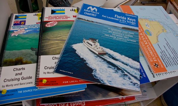 Private companies have for years been offering booklets of multiple charts. Some are overlaid with information on best routes to take and fishing areas. Even as electronic navigation becomes more widespread, some boaters will still want a backup chart on paper, regardless of who printed it.Now Online: PDFs of Most Charts To Print At Home
Yet another option for mariner consumers eliminates the middleman altogether. Boaters can now print out their own charts from the newly available PDF files that NOAA’s Office of Coast Survey has put on line as of Tuesday, October 22.
 One of the options available at NOAA-OCS’s PDF site: sections of the larger chart that can be printed out on 8-1/2“x11” pages.
NOAA’s OCS is offering the Nautical Charts in downloadable format for a three-month trial. The NOAA OCS website says that it’s looking for feedback and will evaluate usage before deciding whether to make the PDF’s a permanent thing.
Forsythe allows that most homes do not have “an amazing printer” that would accommodate the 36 to 46 inch wide charts, but she notes that on the NOAA OCS site, charts are offered in a booklet format. It breaks down the large charts in to several pages each. Each of them, when printed, would fit on to a standard 8-1/2” x 11” piece of paper.
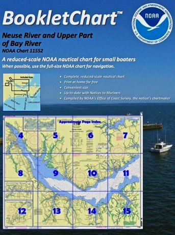
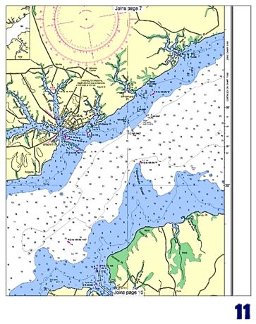 One section of chart 11552, honing in on the Oriental area. This is now downloadable from the NOAA site which this week made most of its charts available in PDF form for a three-montht trial.
“We’re trying to make sure there’s a range of products,” says Forsyth.
The PDF’s being on line, means she says that a kayaker, for instance, could use a mobile phone or other handheld device to consult a chart.
Those using the charts, small boats and big, are encouraged to let NOAA know how those PDF’s are working. A link to give feedback is available at the OCS website.
Along With Change, Appreciation Of The 150 Year TraditionIn making the announcement Tuesday, NOAA gave almost a six month notice that the government was getting out of the nautical chart printing business.
Dawn Forsythe says the lithographic charts have a “150 year heritage.” It was the Civil War that prompted the printing, in 1862. The Federal government ramped up the mass production of the charts it needed for the war effort. For a long time after that, sailors and mariners came to depend upon them
“People do love their lithographic charts,” Forsythe says. “They’re a beautiful product and people are sad to see them go.”
Some are trying to preserve some of that.
At the Inland Waterway Provision Company, Pat Stockwell has been conducting a survey of his own of customers who bought charts in the past year. 25% he says, say they were planning to use them for navigation. However, 75% said they were going to frame them. Paper charts had become primarily art.
After NOAA’s annoucement that April 13 will be the end of the printing runs, Stockwell says he sold some charts on Wednesday to those who see the end of the era coming.