It's Monday September 28, 2026 Dock Quote: “When there are...
News From The Village Updated Almost Daily


Tropical Storm Hanna Forecaster's Discussion & Computer Models
|
||||||||||||||
Tropical Storm Hanna Forecaster's Discussion # |
| A graphic showing several computer modeled projected tracks is at the bottom of this page. |
Tropical Storm Hanna Discussion Number 2 NWS National Hurricane Center Miami FL AL082026 500 PM AST Mon Sep 28 2026 Since this morning, Hanna's convective structure has become a little more disheveled with the tropical storm is affected by 20-25 kt of westerly vertical wind shear. There has not been an appreciable change in the subjective or objective intensity estimates this afternoon, and the initial intensity is held at 40 kt. The initial motion of Hanna is east-southeastward at 115 degrees at 15 kt. Hanna is embedded in the flow in between a longwave trough to its northeast, and a larger subtropical ridge to its south. This synoptic pattern should result in a continued east-southeastward motion over the next 24-36 hours with some gradually slow down in the track as the mid-latitude trough leaves Hanna behind. Much of the track guidance then shows a slow east-northeastward motion after the cyclone becomes more vertically shallow and becomes influenced by a low-level ridge centered south of the Azores. The NHC track forecast is very similar to the previous one, roughly in between the simple (TVCN) and corrected consensus (HCCA) aids. Vertical wind shear over Hanna is expected to persist in over the next 48-72 h, though because the tropical storm is currently moving in the same direction as the shear vector, bursts of deep convection down-shear of the center may allow for some slight intensification, which is reflected in the HCCA intensity guidance. However, when Hanna slows down and turned more east-northeastward, the shear is expected to shift more out of the north, importing very dry tropospheric air into the circulation. Simulated satellite imagery from the ECMWF and hurricane-regional models still show convection ceasing over the storm in around 60 h, marking its transition to a post-tropical cyclone in the forecast. FORECAST POSITIONS AND MAX WINDS INIT 28/2100Z 36.5N 48.7W 40 KT 45 MPH 12H 29/0600Z 35.5N 46.1W 45 KT 50 MPH 24H 29/1800Z 34.3N 44.3W 45 KT 50 MPH 36H 30/0600Z 33.9N 43.4W 40 KT 45 MPH 48H 30/1800Z 34.2N 42.5W 35 KT 40 MPH 60H 01/0600Z 34.8N 41.0W 30 KT 35 MPH...POST-TROP/REMNT LOW 72H 01/1800Z 36.0N 38.6W 30 KT 35 MPH...POST-TROP/REMNT LOW 96H 02/1800Z...DISSIPATED $$ Forecaster Papin |
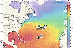
The Forecaster's Discussion above often refers to several computer models. The graphic below includes multiple projected paths, showing what the different computer models indicate. The black line is the NHC (National Hurricane Center) path. This graphic is not an official NHC product. For the official NHC projected path of Tropical Storm Hanna click here.

click image for a larger view
For more information about tropical storm computer models click here.